 Inglis 1898

|

|
|
|
item:- JandMN (159) image:- © see bottom of page |
click to enlarge |
|
|
Road book, The Contour Road Book of England, Western
Division, by Harry R G Inglis, published by Gall and Inglis,
25 Paternoster Square, London and Edinburgh, 1900.
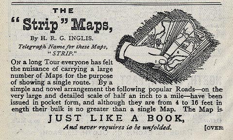
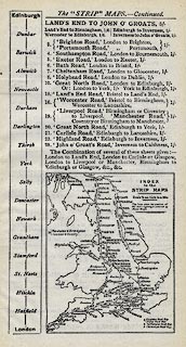
The road book includes - street maps, road maps, gazetteer, itineraries of routes each with a gradient diagram, advertisements, etc. One of the advertisements describes a series of 'Strip' Maps, including the Land's End Road, and the Carlisle Road, which cross Cumbria. |
||

|
Inglis 1898 | |
| inscription:- |
printed title page
THE / 'CONTOUR' ROAD BOOK / OF / ENGLAND / (WESTERN DIVISION) / INCLUDING WALES. / A Series of Elevation Plans of the Roads, / with Measurements and Descriptive / Letterpress. / BY HARRY R. G. INGLIS. / Author of the 'Contour Road Book of Scotland.' / With 500 Maps and Plans. / / London : / GALL AND INGLIS, 25 PATERNOSTER SQUARE; / AND EDINBURGH / 1900 / (Copyright.) |
|
| wxh:- | 9.5x16cm | |
|
||