 Lewis 1835

|

|
|
|
item:- JandMN (210) image:- © see bottom of page |
click to enlarge |
|
|
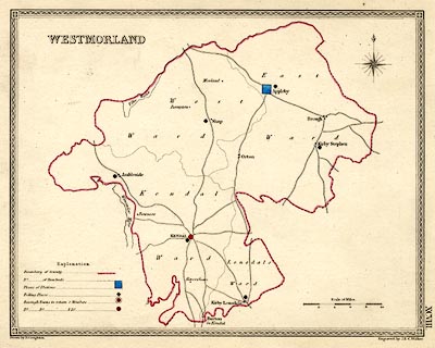
Map, political map, Westmorland, scale about 6 miles to 1
inch, drawn by R Creighton, engraved by J and C Walker,
published by S Lewis and Co, 87 Aldersgate Street, London,
1835.
Published in A Topographical Dictionary of England, 3rd edition vol.5 plate 98. |
||

|
Lewis 1835 | |
| map feature:- | compass rose & up is N & scale line & table of symbols & lakes & county & settlements & roads & electoral data | |
| scale line:- | 10 miles = 43.0 mm | |
| scale:- | 1 to 370000 ? (1 to 374266 from scale line) | |
| wxh, sheet:- | 28x22cm | |
| wxh, map:- | 228x178mm | |