 Hill c1751

|

|
|
|
item:- Carlisle Library : Map 54 image:- © Carlisle Library |
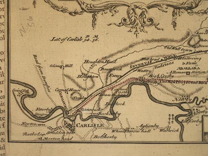
click to enlarge | |
| Illustration of part of map only. | ||
|
Road map, uncoloured engraving, Survey of the Country
between Newcastle and Carlisle, scale about 1.5 miles to 1
inch, for a new military road, by N Hill, about 1751.
Construction of the Military Road began 1751. |
||

|
Hill c1751 | |
| inscription:- |
printed foliage cartouche, upper left
A SURVEY / of the country between NEWCASTLE and CARLISLE, representing / the several present ROADS and the TRACT which is proposed for / the New Intended ROAD of Communication between the TOWNS. / As also the Course of the ROMAN WALL with all the Military / STATIONS, CASTALLA amd Military Ways that lye / upon this SURVEY. |
|
| inscription:- |
printed bottom right
N Hill Sculpt. |
|
| inscription:- |
printed with scale line
A Scale of Miles |
|
| scale line:- | 6 miles = 107.2 mm | |
| wxh, sheet:- | 53x40cm | |
| wxh, map:- | 1046x176mm | |
| scale:- | 1 to 90000 ? (1 to 90075 from scale line, assuming a statute mile) | |