 Our Own Country 1900s

|

|
|
|
item:- Dove Cottage : 2008.107.257 image:- © see bottom of page |
click to enlarge |
|
|
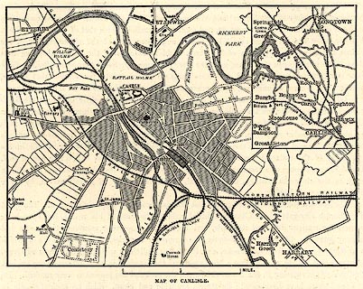
Town plan, uncoloured engraving, Map of Carlisle,
Cumberland, scale about 2 inches to 1 mile, published 1900s?
On p.268 of Our Own Country. An inset map shows Carlisle in the surrounding country. |
||

|
Our Own Country 1900s | |
| map feature:- | north point & up is N & scale line & rivers & settlements & roads & railways & race courses & inset map | |
| inscription:- |
printed bottom
MAP OF CARLISLE. |
|
| scale line:- | 1 mile = 47.0 mm | |
| wxh, sheet:- | 19x26.5cm | |
| wxh, image:- | 139x104mm | |
| scale:- | 1 to 34000 ? (1 to 34241 from scale line) | |