 Rodwell 1834

|

|
|
|
item:- Armitt Library : ALMC2008.14.50 image:- © see bottom of page |
click to enlarge |
|
|
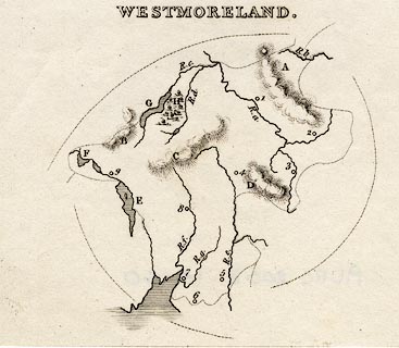
Map, uncoloured engraving, Westmoreland ie Westmorland,
by Mary Martha Rodwell, published by Longman, Rees, Orme,
Brown, Green and Longman, London, 1834.
Included in The Geography of the British Isles. The bottom part of the sheet is missing. There is descriptive text with the map, pp.25-30, on three loose sheets |
||

|
Rodwell 1834 | |
| map feature:- | up is N & sea shaded & coast line & rivers & lakes & relief & hill hachuring & woods & county (no outline) & settlements | |
| inscription:- |
printed top
WESTMORELAND. |
|
| wxh, sheet (incomplete):- | 10.5x9cm | |
| wxh, map:- | 9x8cm (?) | |