 Johnson 1847

|

|
|
|
item:- Armitt Library : ALMC2008.14.44 image:- © see bottom of page |
click to enlarge |
|
|
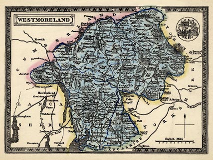
Map, hand coloured engraving, Westmoreland ie
Westmorland, scale about 6 miles to 1 inch, engraved by
Lizars, Edinburgh, published by Thomas Johnson, Manchester,
1847.
Included in Johnson's Atlas of England, which is a railway atlas, but this map has no railways (is it correctly identified?) There is a ?badge of Kirkby Kendal, date 1576, upper right. |
||

|
Johnson 1847 | |
| map feature:- | plain cartouche & vignettes & decorative border & north point & up is N & scale line & lat and long scales (rectangular projection?) & sea shaded (?) & coast line & rivers & lakes & relief & hill hachuring & forests & parks & county & wards & settlements & roads | |
| inscription:- |
printed title cartouche, upper left
WESTMORELAND |
|
| inscription:- |
printed above scale line
English Miles |
|
| scale line:- | 10 miles = 42.5 mm | |
| longitude, Kendal:- | 2d 49m W (?) | |
| wxh, sheet:- | 28x21.6cm | |
| wxh, map:- | 229x165mm | |
| scale:- | 1 to 380000 ? (1 to 378669 from scale line assuming a statute mile) | |