 RAC 1920s

|

|
|
|
item:- JandMN (131) image:- © see bottom of page |
click to enlarge |
|
|
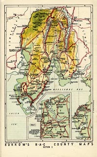
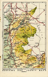
Road map, The RAC County Road Map and Gazetteer, No.18,
Lancashire, scale about 4 miles to 1 inch, published for the
Royal Automobile Club, RAC, by E J Burrow and Co,
Cheltemham, Gloucestershire and London, late 1920s?
The booklet has - title page with contents list, frontispiece, descriptive text, gazetteer of places worth visiting, an index map and 5 pages of colour printed road maps of the counties, a map of circular tours and recommended itineraries, besides many local advertisements indexed to the maps. The book includes Lancashire North of the Sands, part of the Lake District. |
||

|
RAC 1920s | |
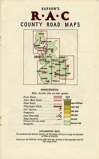
| map feature:- | table of symbols & up is N & scale line & index grid (6 mile squares) & sea plain & coast tinted & rivers & lakes & relief & contours & layer colouring & spot heights & table of heights & woods & forests & county & settlements & roads | |
| inscription:- |
printed cover
The / R.A.C / COUNTY / ROAD MAP / & GAZETTEER. / Lancashire / EVERY OBJECT OF INTEREST / IN THE COUNTY AT A GLANCE / AND HOW TO GET THERE / 1/6 NET black and orange on brown; outline map of the area |
|
| inscription:- |
printed title page
LANCASHIRE / CONTENTS / ... / THE R.A.C. COUNTY ROAD MAP / AND GAZETTEER / No.18 of a Series of 21 / ... / PUBLISHED BY ED. J. BURROW & CO. LTD. / Cheltenham; and 43, 45, 47 Kingsway, London, W.C. / ... |
|
| scale line:- | 6 miles = 38.2 mm | |
| scale:- | 1 to 250000 ? (1 to 252777 from scale line) | |
| wxh:- | 15.5x25cm | |
|
||
|
||