 Philip 1900s

|

|
|
|
item:- JandMN : JIG328 image:- © see bottom of page |
click to enlarge |
|
|
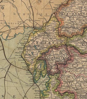
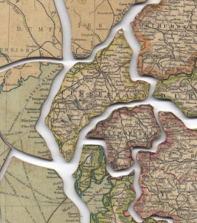
Map, plywood jigsaw puzzle, England and Wales, scale
about 17.5 miles to 1 inch, by George Philip and Son Ltd,
The London Geographical Institute, made 1900s?
|
||

|
Philip 1900s | |
| map feature:- | up is N & scale line & table of symbols & sea tinted & coast line & coast tinted & rivers & lakes & relief & hill hachuring & county & roads & railways & shipping routes | |
| jigsaw feature:- | colour printed & paper backed (green) hand cut & 100 piece (96?) & interlocking border & non interlocking pieces & picture pieces (counties) & big pieces | |
| inscription:- |
printed upper right
ENGLAND AND WALES |
|
| inscription:- |
printed bottom, left and right
George Philip & Son, Ltd. / The London Geographical Institute |
|
| scale line:- | 50 miles = 72 mm (about) | |
| wxh, jigsaw:- | 54x65cm | |
| scale:- | 1 to 1100000 ? (1 to 1117600 from scale line) | |
|
||
|
|
notes | |