 Sanson 1679

|

|
|
|
item:- Dove Cottage : 2007.38.15 image:- © see bottom of page |
click to enlarge |
|
|
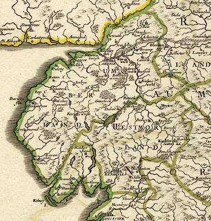
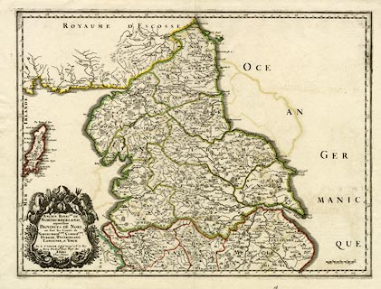
Map, hand coloured engraving, Ancien Royaume de
Northumberland aujourdhuy Provinces de Nort, ie the Ancient
Kingdom of Northumberland or the Northern Provinces, scale
about 9.5 miles to 1 inch, by Nicholas Sanson, Paris,
France, 1679.
Includes parts of Northumberland, Cumberland, Durham, Westmorland, Lancashire, and Yorkshire. |
||

|
Sanson 1679 | |
| map feature:- | baroque cartouche & up is N & scale line & lat and long scales (E from Cape Verde Islands? trapezoid projection) & sea plain & coast shaded & rivers & lakes & relief & hillocks & woods & forests & county & settlements | |
| inscription:- |
printed title cartouche, lwoer left
ANCIEN ROYAUME DE / NORTHUMBERLAND, / aujourdhuy / PROVINCES DE NORT : / ou sont les Comtes de / NORTHUMBERLAND, CUMBERLAND, / DURHAM, WESTMORLAND / LANCASTER, et YORCK. / Par le Sr. SANSON d'Abby Geogr. ord du Roy / Avecq Privilege RE. pour Vingt Ans / A PARIS / Chez l'Auteur / 1679. |
|
| inscription:- |
printed below scale line, lower right
Milles Communs d'Anglet. |
|
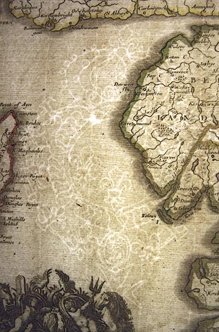
| inscription:- |
water mark:
coat of arms? and crown |
|
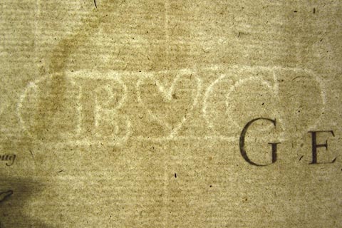
| inscription:- |
water mark:
B C heart |
|
| scale line:- | 16 miles = 42.4 mm | |
| longitude, Kendal:- | 17d 48m E | |
| wxh, sheet:- | 56.5x42.5cm | |
| wxh, plate:- | 511x386mm | |
| wxh, map:- | 508x379mm | |
| scale:- | 1 to 600000 ? (1 to 607300 from scale line wrongly assuming a statute mile) | |
|
||
|
||
|
||