 Mountains of Crummock and Buttermere

|

|
|
|
item:- Armitt Library : A1175.7 image:- © see bottom of page |
click to enlarge |
|
|
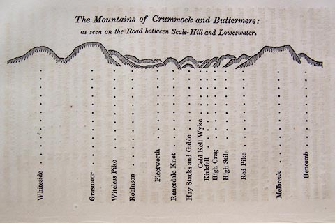
Print, engraving, outline view, The Mountains of Crummock
and Buttermere as seen on the Road between Scale-Hill and
Loweswater, published by Jonathan Otley, Keswick, Cumberland
et al, 1830.
p.125 in A Concise Description of the English Lakes, by Jonathan Otley, 4th edition, 1830. |
||
| source type:- | Otley 1823 (4th edn 1830) | |
| inscription:- |
printed top
The Mountains of Crummock and Buttermere : / as seen on the Road between Scale-Hill and Loweswater. |
|
| inscription:- |
printed bottom
Whiteside / Grasmoor / Witeless Pike / Robinson / Fleetworth / Rannerdale Knot / Hay Stacks and Gable / Cold Kell Wyke / Kirkfell / High Crag / High Stile / Red Pike / Melbreak / Hencomb |
|