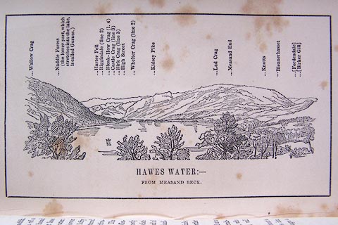
 Hawes Water from Measand Beck

|

|
|
|
item:- Armitt Library : A1180.10 image:- © see bottom of page |
click to enlarge |
|
|
Print, engraving, outline view of mountains, Hawes Water
from Measand Beck, drawn by Mr Binns, Halifax, engraved by
Mr Jewitt, Headington, Oxfordshire, published by Jonathan
Otley, Keswick, Cumberland et al, 1849.
Opposite p.16 of A Descriptive Guide of the English Lakes, by Jonathan Otley, 8th edition, 1849. |
||
| source type:- | Otley 1823 (8th edn 1849) | |
| inscription:- |
printed bottom
HAWES WATER : - / FROM MEASAND BECK. |
|
| inscription:- |
printed top
Wallow Crag / Naddle Forest (the lower part, which stretches into the lake, is called Gurnes.) / Harter Fell / Riggindale (line 2) / Bleak-How Crag (l.4) / Castle Crag (line 3) / High Street / Whelter Crag (line 2) / Kidsey Pike / Lad Crag / Measand End / Knotts / Blennerhasset / (Fordendale) / (Birker Gill) |
|