
private collection (80)
image:-
© see bottom of page

click to enlarge

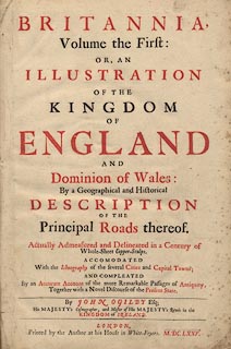
BRITANNIA, / Volume the First : / OR, AN / ILLUSTRATION / OF THE / KINGDOM / OF / ENGLAND / AND / Dominion of Wales : / By a Geographical and Historical / DESCRIPTION / OF THE / Principal Roads thereof. / Actually Admeasured and Delineated in a Century of / Whole-Sheet Copper-Sculps. / ACCOMODATED / Witht eh Ichnography of the several Cities and Capital Towns; / AND COMPLEATED / By an Accurate Account of the more Remarkable Passages of Antiquity, / Together with a Novel Discourse of the Present State. / By JOHN OGILBY Esq; / His MAJESTY's Cosmographer, and Master of His MAJESTY's Revels in the / KINGDOM of IRELAND. / LONDON, / Printed by the Author at his House in White-Fryers. M.DC.LXXV.
red and black on white
 Ogilby 1675