 Paterson 1785

|

|
|
|
item:- private collection (19) image:- © see bottom of page |
click to enlarge |
|
|
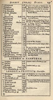
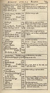
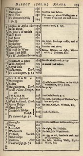
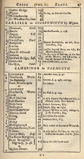
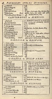
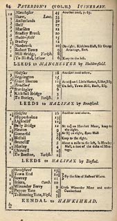
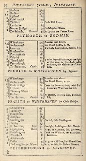
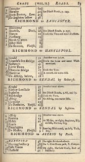
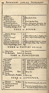
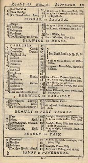
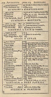
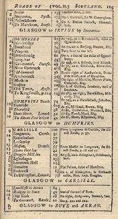
Road book, 2 volumes, Paterson's British Itinerary,
including road strip maps with sections in Westmorland,
Cumberland, etc, scales about 2.5-3 miles to 1 inch, by Capt
Daniel Paterson, London, 1785; published 1785-1807.
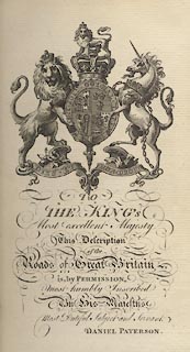
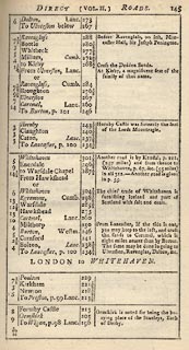
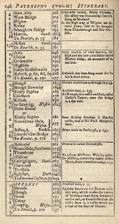
Volume 1 has - a general map of England and Wales, tile page, dedication page, contents list, directions to the book binder, oreface including a table of hire charges for horses and carriages, index to the direct roads, index to the cross roads, index to the scotch (sic) roads, 186 strip maps of direct roads 2 to a page, itinerareis of lesser direct roads, circuits of the judges. Volume 2 has - title page, 142 strip maps of direct roads 2 to a page, itineraries of lesser direct roads, subordinate title page, 30 strip maps of cross roads 2 to a page, itineraries of lesser cross roads, subordinate title page, itineraries of scotch roads. The general map and relevant strip maps are recorded separately. |
||

|
Paterson 1785 | |
| inscription:- |
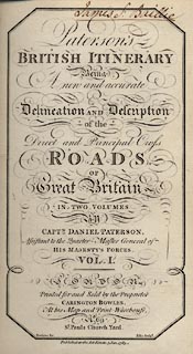
printed title page, vol.1
Paterson's / BRITISH ITINERARY / Being / A new and accurate / Delineation and Description / of the / Direct and Principal Cross / ROADS. / OF / Great Britain / IN TWO VOLUMES / By / CAPTN. DANIEL PATERSON, / Assistant to the Quarter Master General of / HIS MAJESTY'S FORCES. / VOL. I. / L O N D O N / Printed for and Sold by the Proprietor / CARINGTON BOWLES, / At his Map and Print-Warehouse, / No.69 / St. Paul's Church Yard. / Tomkins fec. Ellis sculpt. / Published as the Act directs, 3 Jan. 1785. |
|
| wxh:- | 12x19cm | |
|
||
|
||
|
||
|
||
|
||
|
||
|
||
|
||
|
||
|
||
|
||
|
||
|
||
|
||
|
||