 Paterson 1785

|

|
|
|
item:- private collection (19_0) image:- © see bottom of page |
click to enlarge |
|
|
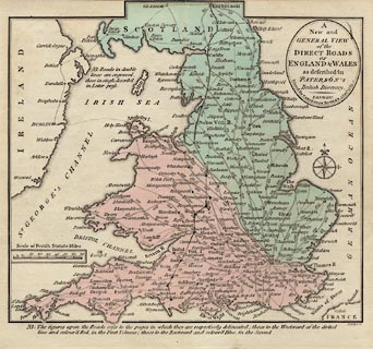
Map, hand coloured engraving, the Direct Roads of England
and Wales, scale about 60 miles to 1 inch, engraved by J
Ellis, published by Carington Bowles, 69 St Paul's
Churchyard, London, 1785.
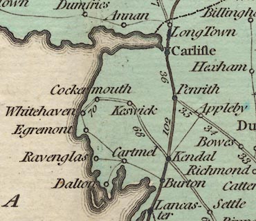
Included in Paterson's British Itinerary, vol.1, by Captain Daniel Paterson, published by Carington Bowles, London, 1785. The map has been defaced by an owner marking a journey from Weymouth to Edinburgh. |
||

|
Paterson 1785 | |
| map feature:- | oval cartouche & compass rose & scale line & sea plain & coast form lines & settlements & roads | |
| inscription:- |
printed title cartouche, upper right
A / New and / GENERAL VIEW / of the / DIRECT ROADS / OF / ENGLAND & WALES / as described in / PATERSON'S / British Itinerary. / Printed for CARINGTON BOWLES 3 Jany. 1785. |
|
| inscription:- |
printed bottom right
J. Ellis sc. |
|
| inscription:- |
printed with scale line
Scale of British Statute Miles. |
|
| scale line:- | 70+10 miles = 36.3 mm | |
| wxh, sheet:- | 20x18.5cm | |
| wxh, map:- | 187x170mm | |
| scale:- | 1 to 3500000 ? (1 to 3546764 from scale line assuming a statute mile) | |
|
||