 Ogilby 1675

|

|
|
|
item:- private collection (14) image:- © see bottom of page |
click to enlarge |
|
|
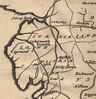
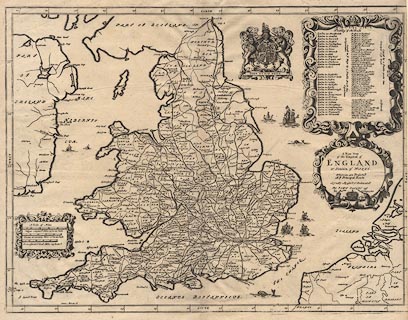
Road map, uncoloured engraving, A New Map of the Kingdom
of England and Dominion of Wales, scale about 26 miles to 1
inch, general map for the road book Britannia, by John
Ogilby, London, after 1675.
This is the middle of three editions of the map; two ships in the Irish sea, etc. |
||

|
Ogilby 1675 | |
| map feature:- | scroll cartouche & coat of arms, royal & labelled borders & up is N & scale lines & lat and long scales & sea plain & galleons & sea monsters & coast shaded & rivers & country & county & settlements & roads & table of data (roads) | |
| inscription:- |
printed title cartouche, middle right
A New Map / of the Kingdom of / ENGLAND / & Dominion of WALES / Whereon are projected / all ye Principal Roads / Actually Measurd & Delineated / By JOHN OGILBY Esqr. / his Maties. Cosmographer |
|
| scale line:- | 50 miles = 48.7 mm | |
| wxh, sheet:- | 51x42.5cm | |
| wxh, map:- | 497x376mm (estimate) | |
| scale:- | 1 to 1700000 ? (1 to 1652304 from middle scale line) | |
|
||