 Ptolemy 1578

|

|
|
|
item:- private collection (13) image:- © see bottom of page |
click to enlarge |
|
|
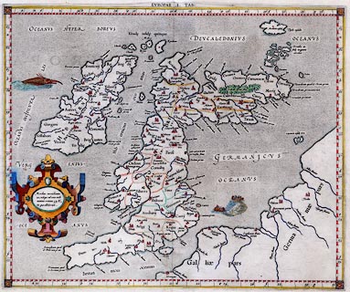
Map, hand coloured engraving, Prima Europe tabula, Europe
Map 1, Ptolemy map of roman Britain, by Gerard Mercator,
1578.
The geographical data in a world gazetteer, The Geography, was compiled by Claudius Ptolemy, 2nd century. |
||

|
Ptolemy 1578 | |
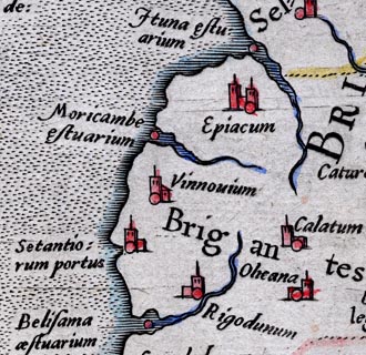
| map feature:- | up is N & lat and long scales & index grid & sea stippled & sea monsters & coast shaded & rivers & tribal areas & settlements | |
| inscription:- |
printed top
EUROPAE .I. TAB : 'Europe Map 1' |
|
| inscription:- |
printed cartouche
Medius meridianus / 20, reliqui ad eum incli : / nantur ratione 54 & / 60 parallelorum |
|
| wxh, map:- | 408x336mm | |
|
||