 Jefferys 1757

|

|
|
|
item:- Hampshire Museums : B1999.518.1757.13.1 image:- © see bottom of page |
click to enlarge |
|
|
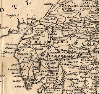
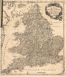
Map, uncoloured engraving, New Map of England and Wales,
scale about 25 miles to 1 inch, by Thomas Jefferys,
published in the Gentleman's Magazine, London, 1757.
Vol.27 1757 supplement, opp p.584. |
||

|
Jefferys 1757 | |
| map feature:- | folded (badly, tipped in magazine) & scroll cartouche & compass rose & up is N & scale line & lat and long scales (trapezoid projection) & coast shaded & rivers & relief & hillocks & county & settlements & roads | |
| inscription:- |
printed title cartouche
A / New MAP of / ENGLAND and WALES / By Thos. Jefferys / Geographer to his Royal / Highness the Prince of / WALES. |
|
| scale line:- | 50 miles = 50.1 mm | |
| scale:- | 1 to 1600000 ? (1 to 1606132 from scale line assuming statute mile) | |
|
||