item:- Armitt Library : A1189.1
image:- © see bottom of page
 LO02.jpg
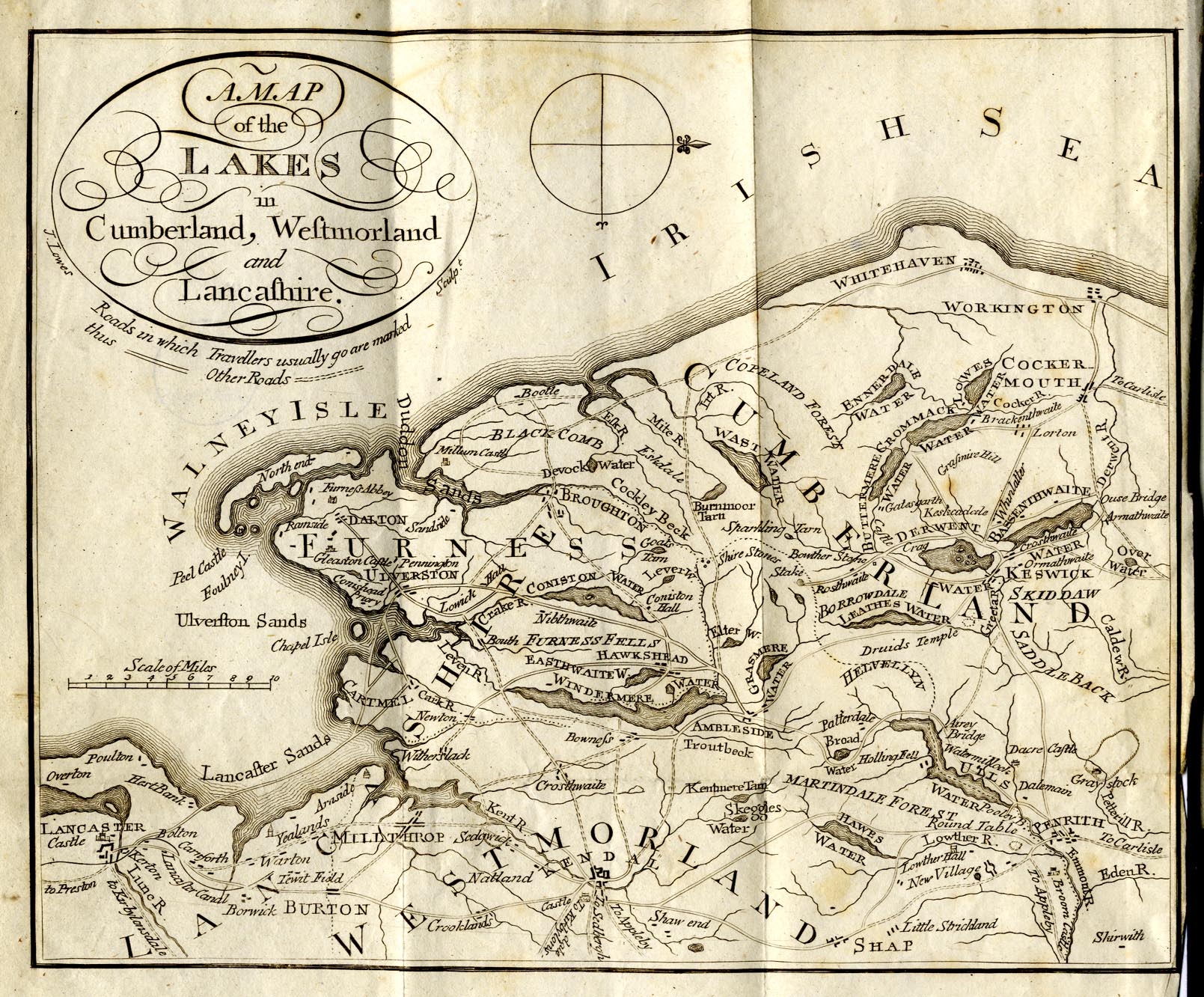
Map, uncoloured engraving, A Map of the Lakes in Cumberland,
Westmorland and Lancashire, scale about 7.5 miles to 1 inch,
engraved by J Lowes, published by J Shaw, Penrith, Cumberland,
1818.
 Lakes Guides menu.