item:- JandMN : 139
image:- © see bottom of page
 KP06.jpg
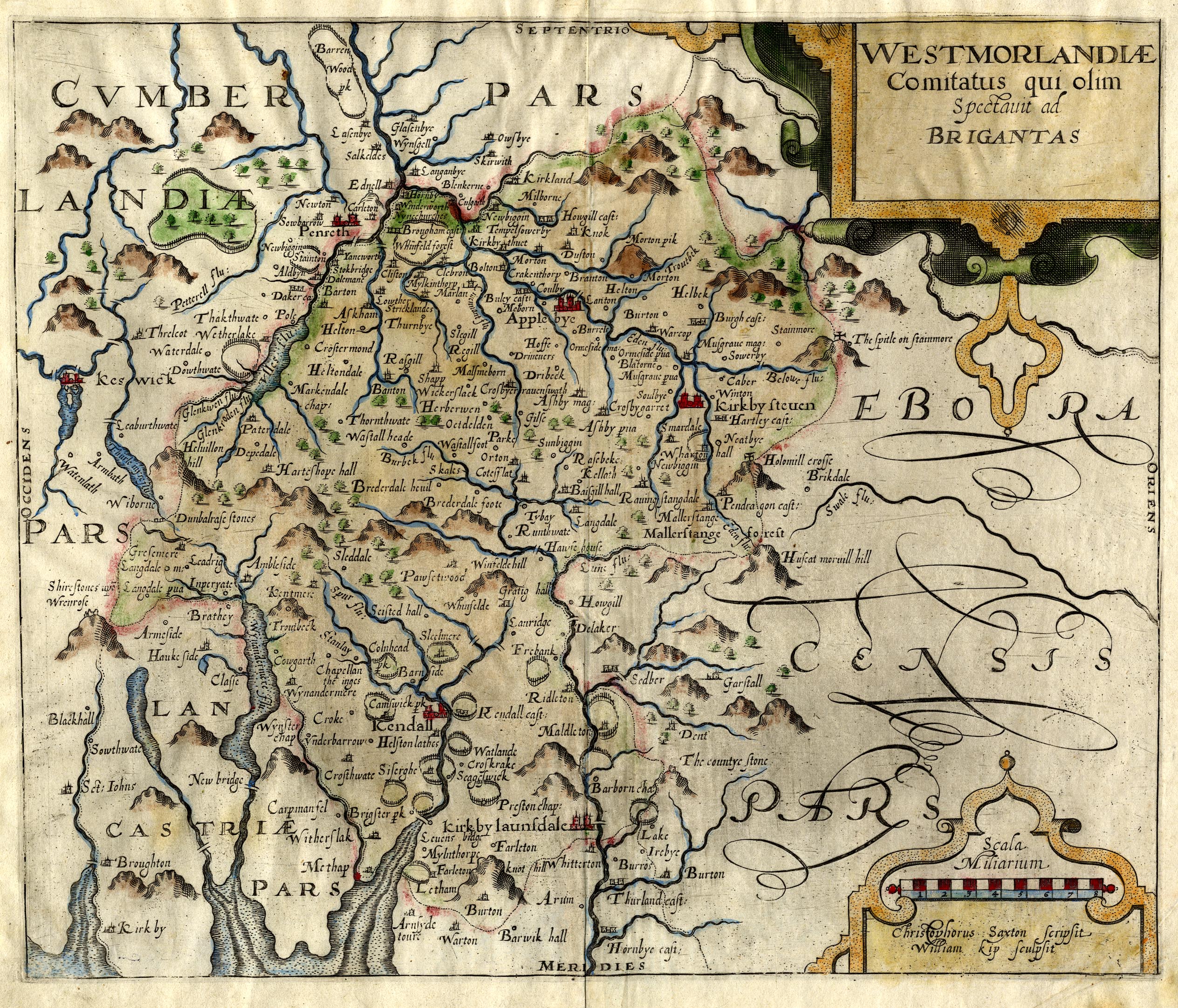
Map, hand coloured engraving, Westmorlandiae Comitatus, ie the
County of Westmorland, scale about 3.5 miles to 1 inch, by
Christopher Saxton, 1576, engraved by William Kip, London, 1607;
published by George Bishop and John Norton, London, 1610.
 Lakes Guides menu.