item:- Armitt Library : 2008.14.73
image:- © see bottom of page
 KN21.jpg
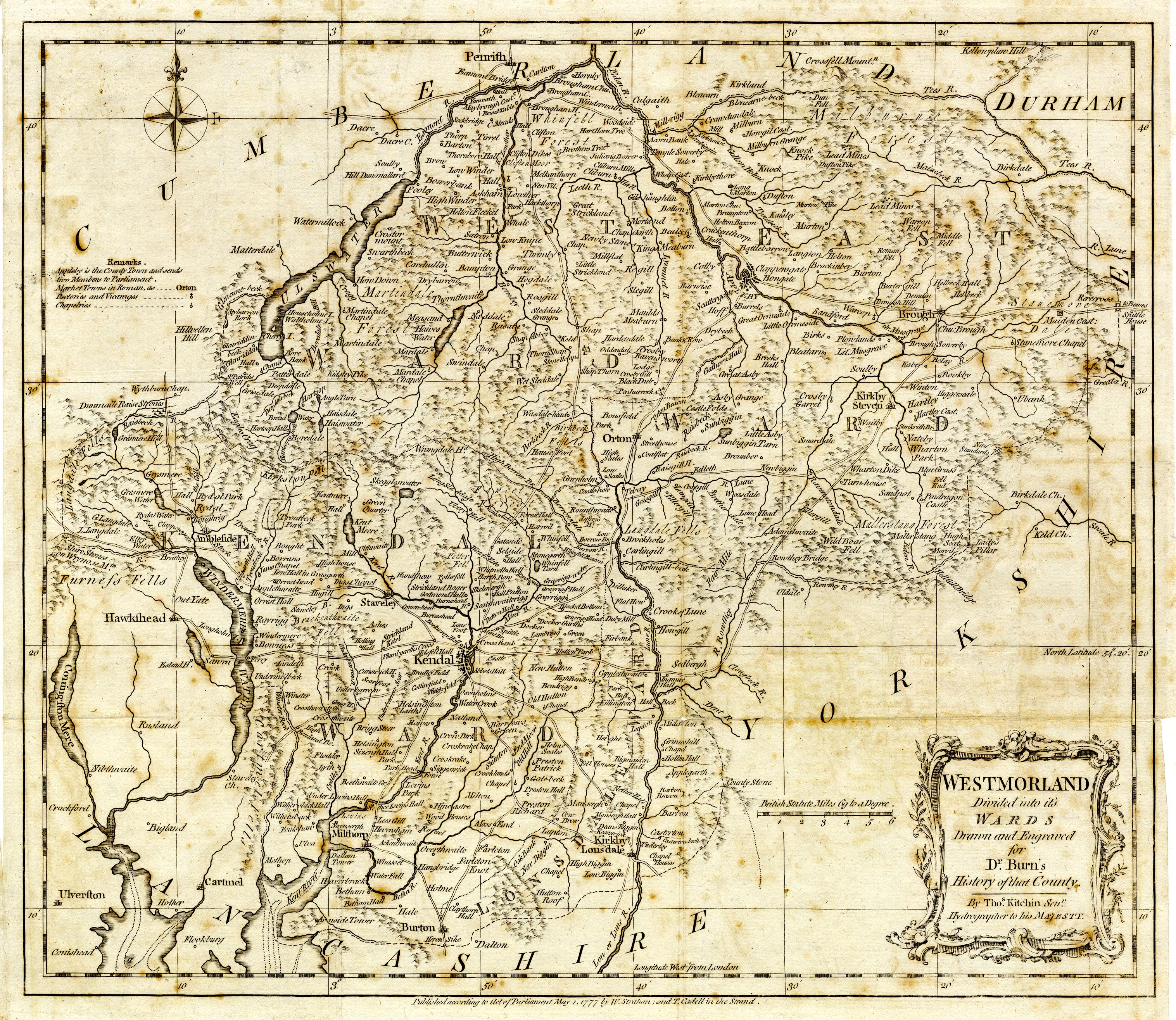
Map, uncoloured engraving, Westmorland, Divided into its Wards, scale about 7 miles
to 1 inch, by Thomas Kitchin, published by W Strahan and T Cadell, Strand, London,
1777.
 Lakes Guides menu.