item:- JandMN : 89
image:- © see bottom of page
 KER5.jpg
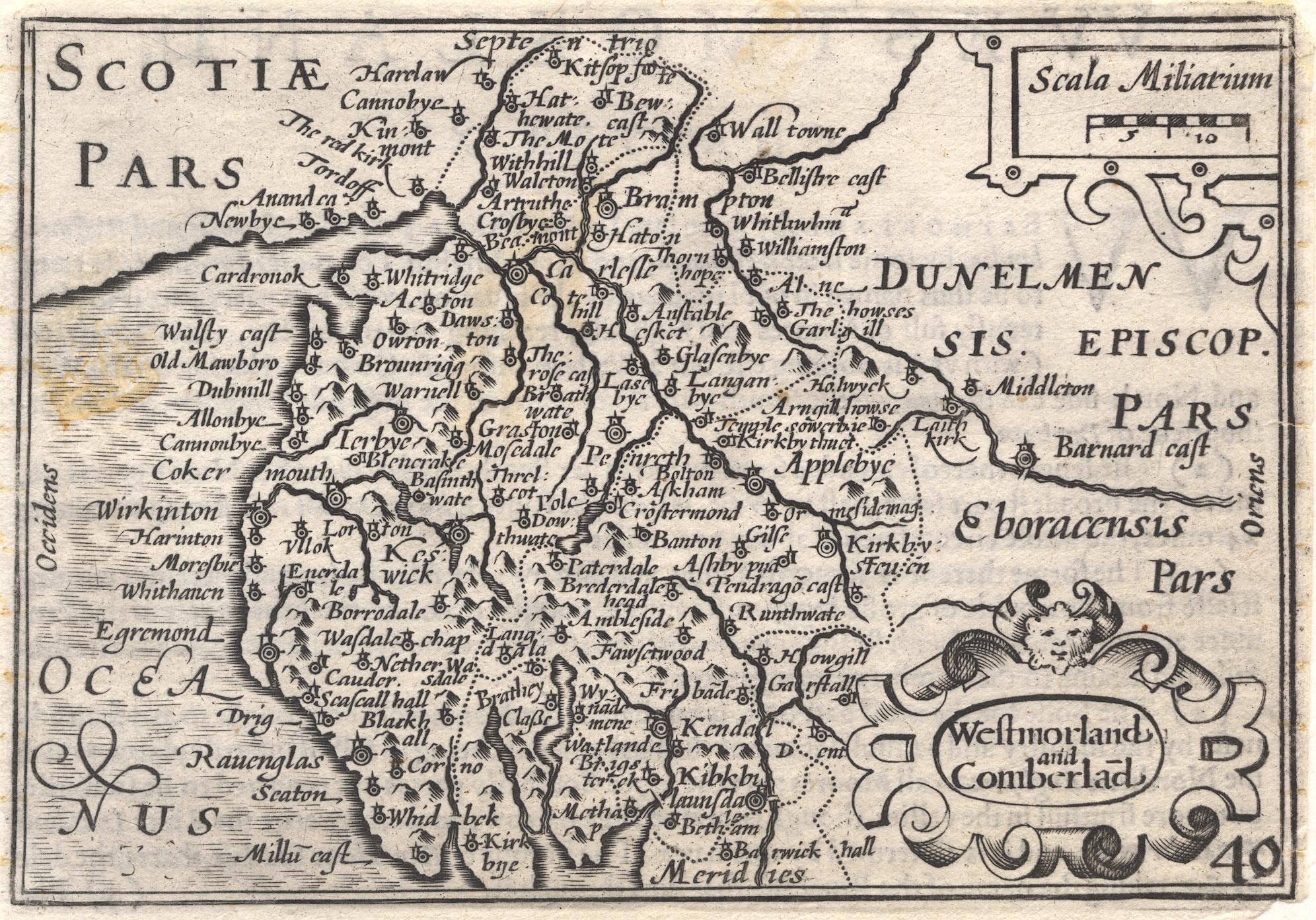
Map, uncoloured engraving, Westmorland and Comberland, scale
about 16 miles to 1 inch, probably by Pieter van den Keere, or
Peter Keer, about 1605, published by Georg Humble, ye Whit
horse, Popeshead Alley, London 1620
 Lakes Guides menu.