 Keer 1605

|

|
|

|
back to object record | |
| MAP FEATURES | ||
|
|
||
|
title cartouche
strapwork cartouche |
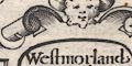
Printed in a strapwork cartouche, decorated with a face, lower right:- Westmorland and Cumberla~d Translated from the Latin of an earlier edition. |
|
|
|
||
|
orientation
labelled borders up is N |
Just inside the four map borders are labels, in Latin,
for the cardinal directions:-
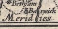
Septentrio / Oriens / Meridies / Occidens The map is printed with North at the top of the sheet. |
|
|
|
||
|
scale line
scale |
Printed in a strapwork cartouche upper right is a:-
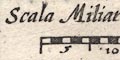
Scala Miliarum chequered in miles, labelled in fives. The 10 miles = 15.3 mm gives a scale 1 to 1051819 wrongly assuming a statute mile. The map scale is about:- 1 to 1100000 16 miles to 1 inch Guessing that the mile is an Old English Mile, the map scale is more likely about:- 1 to 1300000 20 miles to 1 inch |
|
|
|
||
|
sea area
sea moire effect swash lettering |
The sea is patterned by a moire effect. It is labelled
simply:-
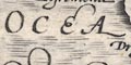
OCEANUS with some swash lettering. |
|
|
|
||
|
coast line
coast shaded |
The coast line is emphasised by shading. |
|
|
|
||
|
rivers
bridges |
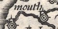
Rivers are drawn by wiggly double lines with form lines, tapering at their head. No river is labelled, but it is possible to recognise a number of the larger streams. 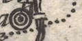
The map has no roads but a few bridges are drawn by a double line crossing and interrupting a stream, perhaps with a suggestion of an arch. There are examples at Kirkby Lonsdale and Levens. |
|
|
|
||
| lakes |
Lakes are drawn by an outline, the interior or just the shore, shaded. No lake is labelled, but it is possible to recognise some, with varying degrees of certainty:- Bassenthwaite Lake Coniston Water Derwent Water Thirlmere Ullswater Windermere and three out of:- Buttermere (?) Crummock Water (?) Ennerdale Water (?) Loweswater (?) |
|
|
|
||
|
relief
hillocks |
Relief is indicated by hillocks, shaded to the east. Theses are scattered in spaces between labels, though it is possible to imagine a central patch of hills, a Pennine chain, the Eden valley, ... |
|
|
|
||
| county |
The county boundaries are a dotted line, which is mostly continued alongside an other boundary feature, except the sea coast. Westmorland, Cumberland and Lancashire are not labelled, but other adjacent counties and country are:- DUNELMENSIS EPISC. PARS Eboracensis Pars SCOTIAE PARS A few features are shown outwith the map's counties for the sake of continuity. |
|
|
|
||
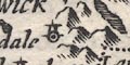
| settlements |
Settlements are marked by a dot and circle, with added
elements. They are differentiated, slightly, unreliably, by
size of labelling.
|
|
|
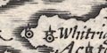
cities
towns |
dot and two circle, tower; labelled in italic lowercase
text which is sometimes a little larger, eg:-
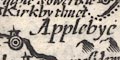
Applebye Kendal Carlesle |
|
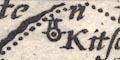
| villages |
dot and circle, tower; labelled in italic lowercase text
which is sometimes a little smaller, eg:-
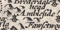
Ambleside Askham Glasenbye |
|
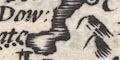
| castles |
dot and circle, tower; labelled in italic lowercase text,
eg:-
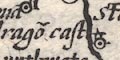
Pendrago~ cast Millu~ cast |
|
Lakes Guides menu.