item:- JandMN : 826.1
image:- © see bottom of page
 JSN3.jpg
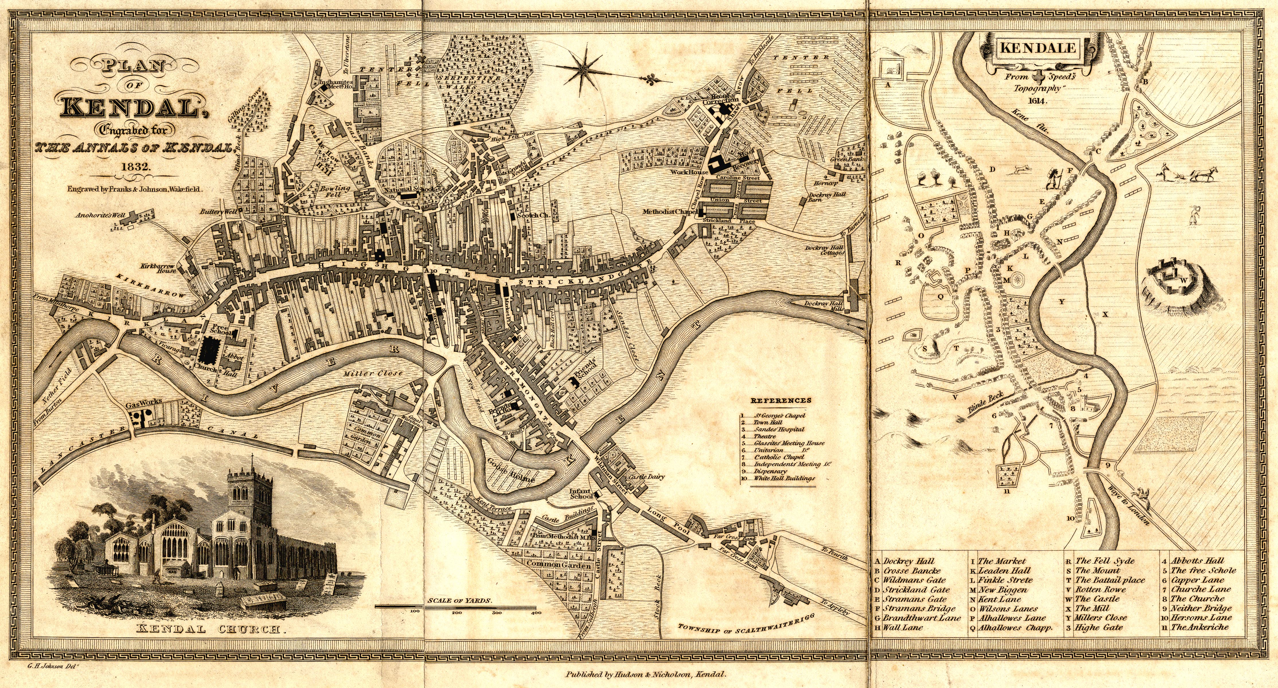
Town plan, uncoloured engraving, Plan of Kendal, scale about 7.5
miles to 1 inch, drawn by G H Johnson, engraved by Franks and
Johnson, Wakefield, Yorkshire, published by Hudson and
Nicholson, Kendal, Westmorland, 1832.
 Lakes Guides menu.