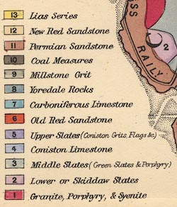
Geological Map of the English Lake District, Westmorland,
Cumberland and Lancashire, now Cumbria, scale about 11.5
miles to 1 inch, published by Edward Stanford, Stanford's
Geographical Establishment, 55 Charing Cross, London, before
1875. (Jenkinson 1875 map 2)
 Lakes Guides menu.