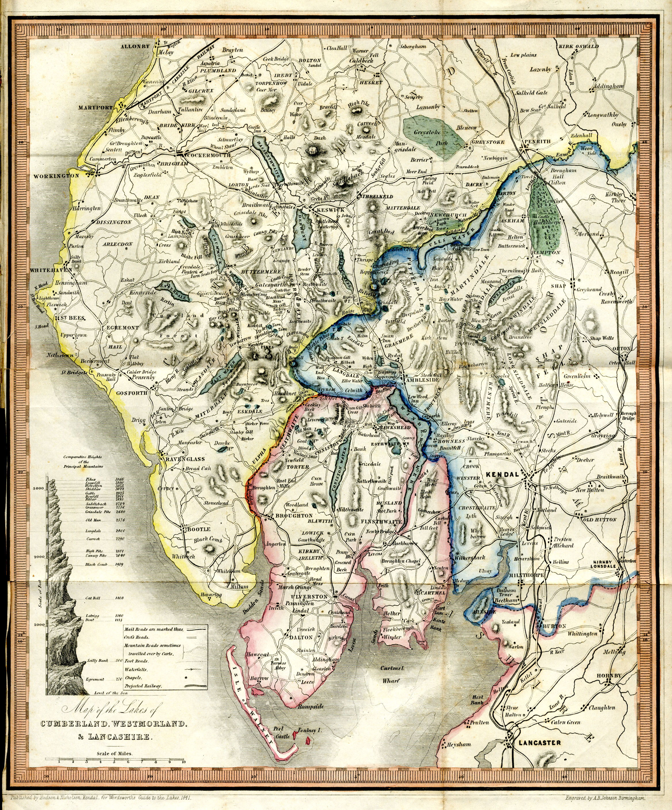
item:- Armitt Library : A1230.1
image:- © see bottom of page
 HUD5.jpg
Map, hand coloured ?engraving, Map of the Lakes of Cumberland,
Westmorland, and Lancashire, scale about 4 miles to 1 inch,
published by Hudson and Nicholson, Kendal, Westmorland, 1842.
 Lakes Guides menu.