 Hudson 1842 map

|

|
|

|
back to object record | |
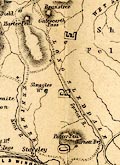
| Hudson 1842 map, Longsleddale | ||
|
Notes about Longsleddale from a Map of the Lakes of
Cumberland, Westmoreland and Lancashire, scale about 3.5
miles to 1 inch, engraved by William Banks, Edinburgh,
included in A Complete Guide to the Lakes, edited John
Hudson, published by John Hudson, Kendal, Westmorland, 1853.
|
||
|
||
|
|
||
| scale |
The map scale is about:-
1 to 220000 3.5 miles to 1 inch |
|
|
Places identified:-
|
||
Lakes Guides menu.