item:- JandMN : 327.13
image:- © see bottom of page
 HUD2.jpg
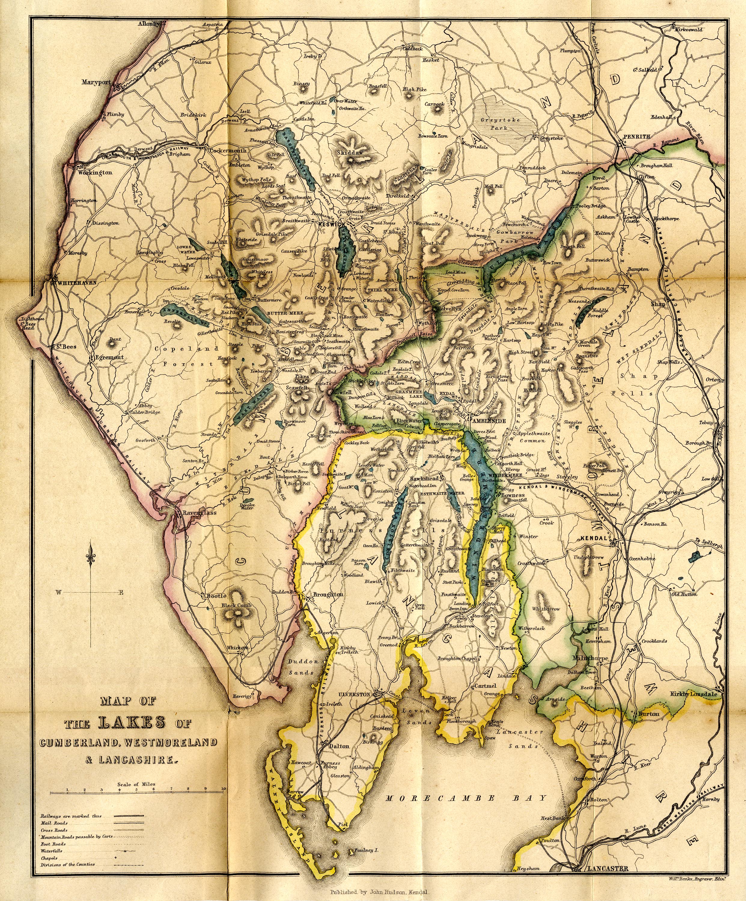
Map, hand coloured lithograph, Map of the Lakes of Cumberland,
Westmoreland and Lancashire, scale about 3.5 miles to 1 inch,
engraved by William Banks, Edinburgh, published by John Hudson,
Kendal, Westmorland, 1853.
 Lakes Guides menu.