item:-
Armitt Library : 2008.14.16
image:-
©
see bottom of page
HN11.jpg
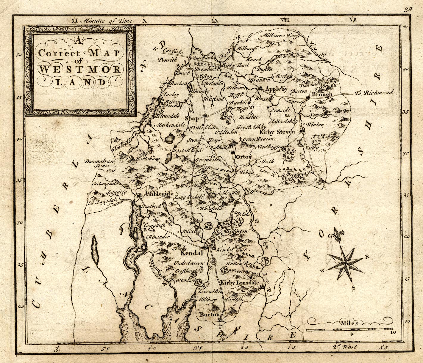
Map, uncoloured engraving, A Correct Map of Westmorland, scale about 7 miles to 1 inch, engraved by Thomas Hutchinson, published by T Osborne et al, 1748.
Lakes Guides menu.
 Lakes Guides menu.