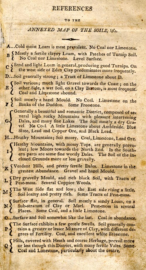
Soil map, Lancashire, Westmoreland, Cumberland and a Part of
Yorkshire, with a Sketch of the Soils, Canals, etc, scale
about 8.5 miles to 1 inch, engraved by J Lowes, published by
F Jollie, Carisle, Cumberland, and C Law, Ave Maria Lane,
London, 1800. (Housman 1800 map 1)
 Lakes Guides menu.