item:- Armitt Library : 1959.193
image:- © see bottom of page
 HEB2.jpg
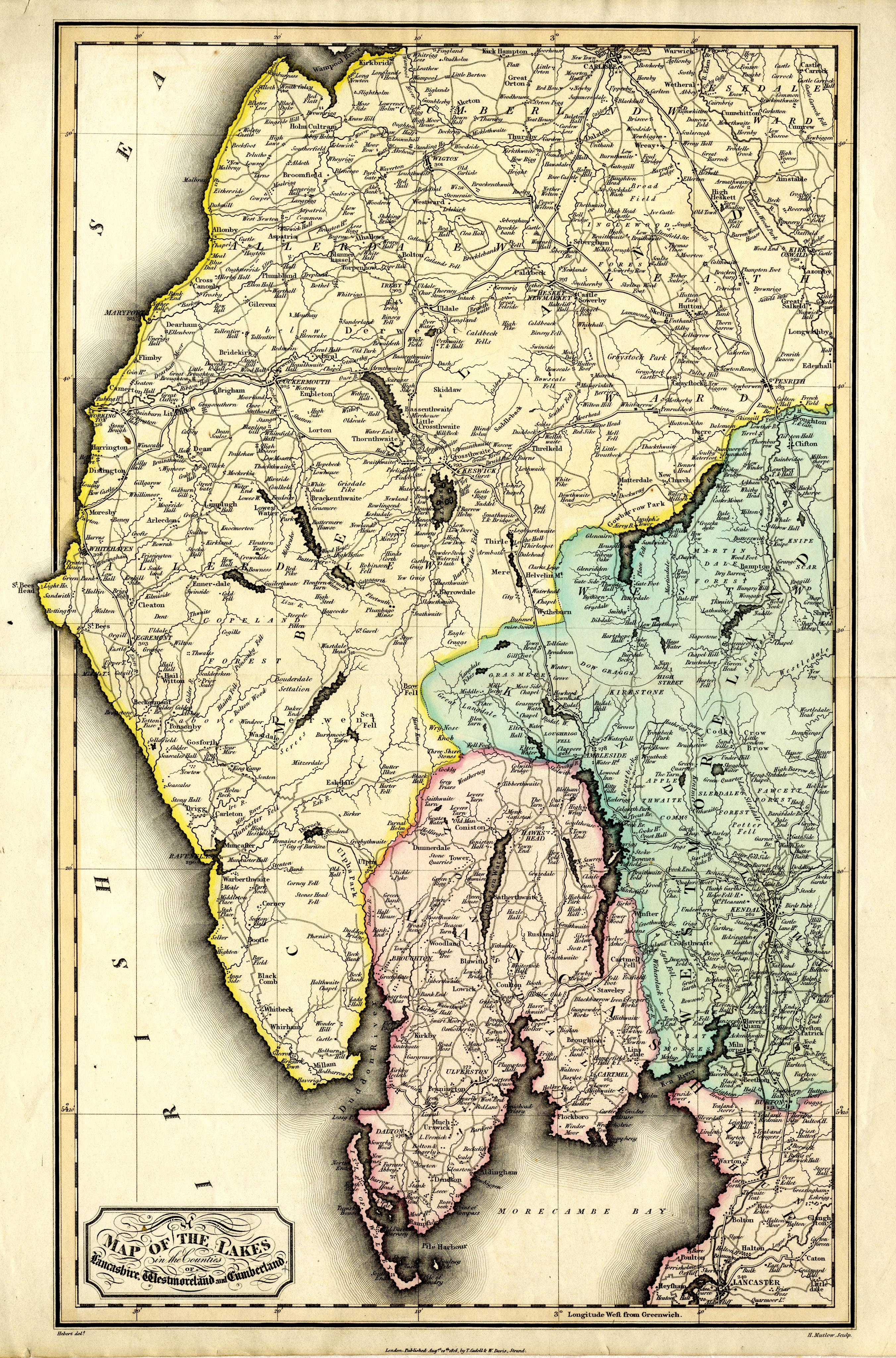
Map, hand coloured engraving, Map of the Lakes in the Counties
of Lancashire, Westmoreland and Cumberland, scale about 3 miles
to 1 inch, drawn by Hebert, engraved by H Mutlow, published by T
Cadell, and W Davies, Strand, London, 1816.
 Lakes Guides menu.