item:- private collection : 161.2
image:- © see bottom of page
 GR02.jpg
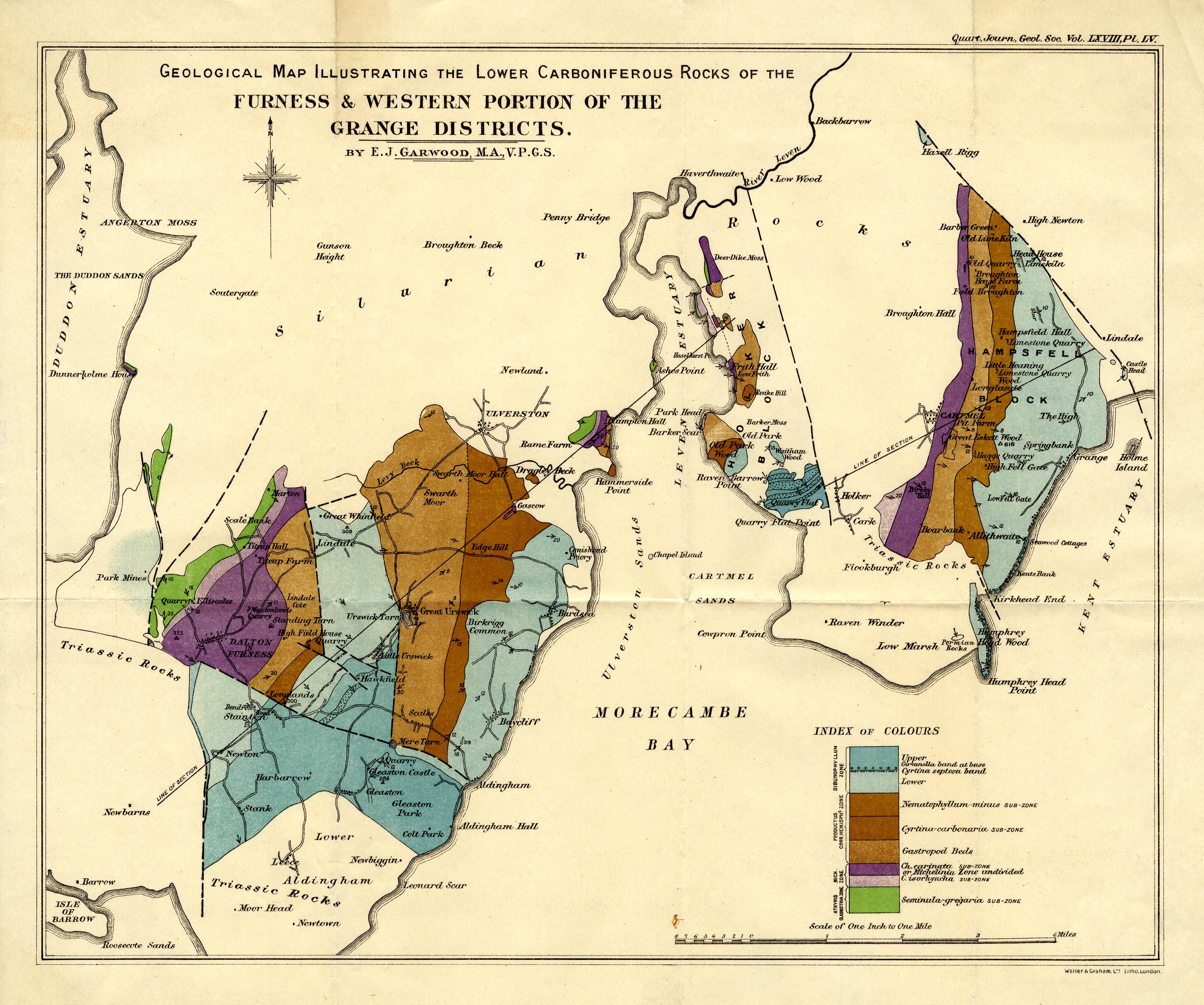
Geological Map, colour lithograph, Geological Map Illustrating
the Lower Carboniferous Rocks of the Furness and Western Portion
of the Grange Districts, scale about 1 inch to 1 mile, by E J
Garwood, engraved by Weller and Graham, published by the
Geological Society of London, 1913.
 Lakes Guides menu.