item:- Armitt Library : A6480.1
image:- © see bottom of page
 GN04M3.jpg
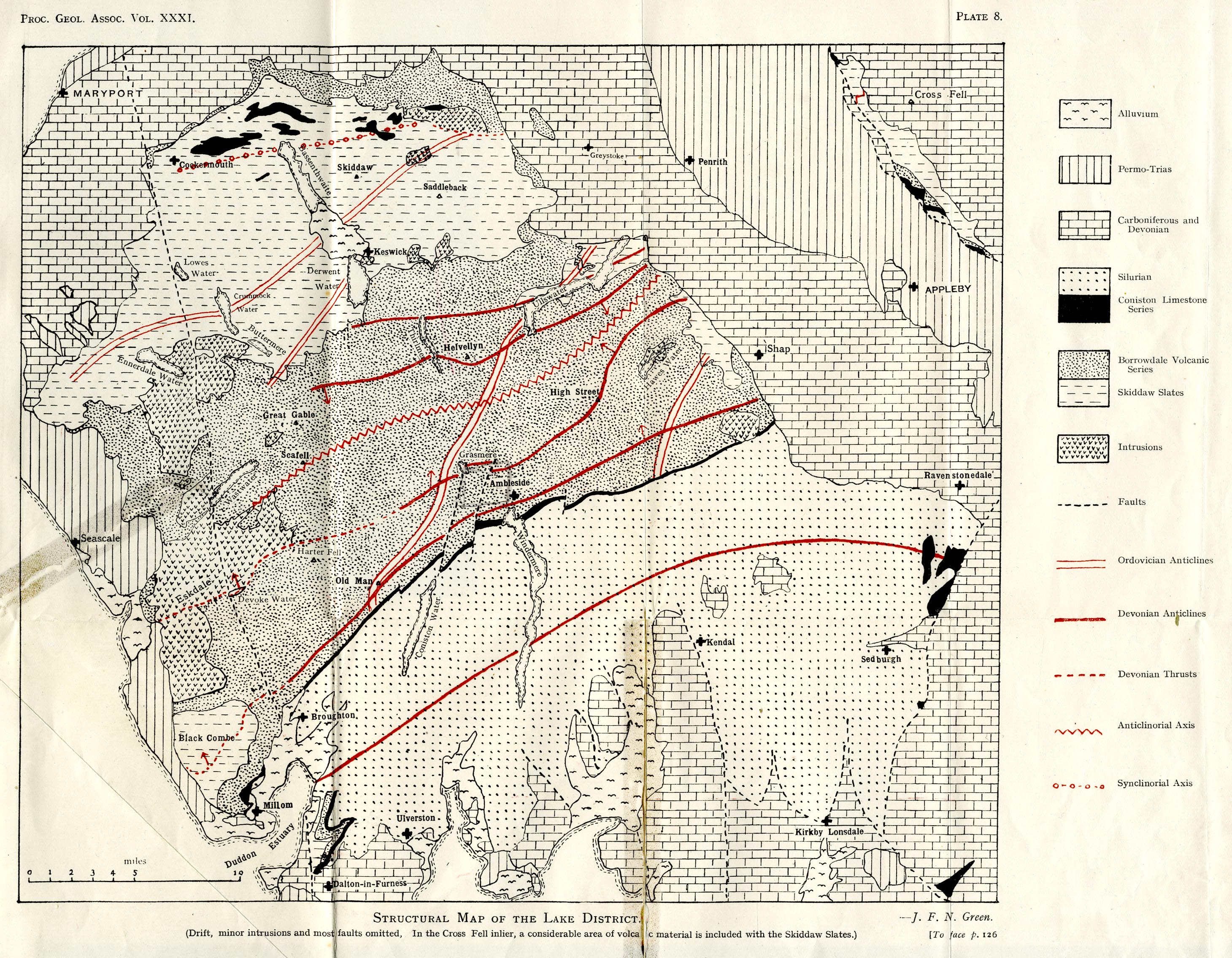
Geological map, lithograph, Structural Map of the Lake District,
scale about 4 miles to 1 inch, by J Frederick N Green, published
in the Proceeding of the Geologists' Association, vol.31
pp.109-126 and plate 8, about 1920.
 Lakes Guides menu.