item:- JandMN : 235.2
image:- © see bottom of page
 GA11.jpg
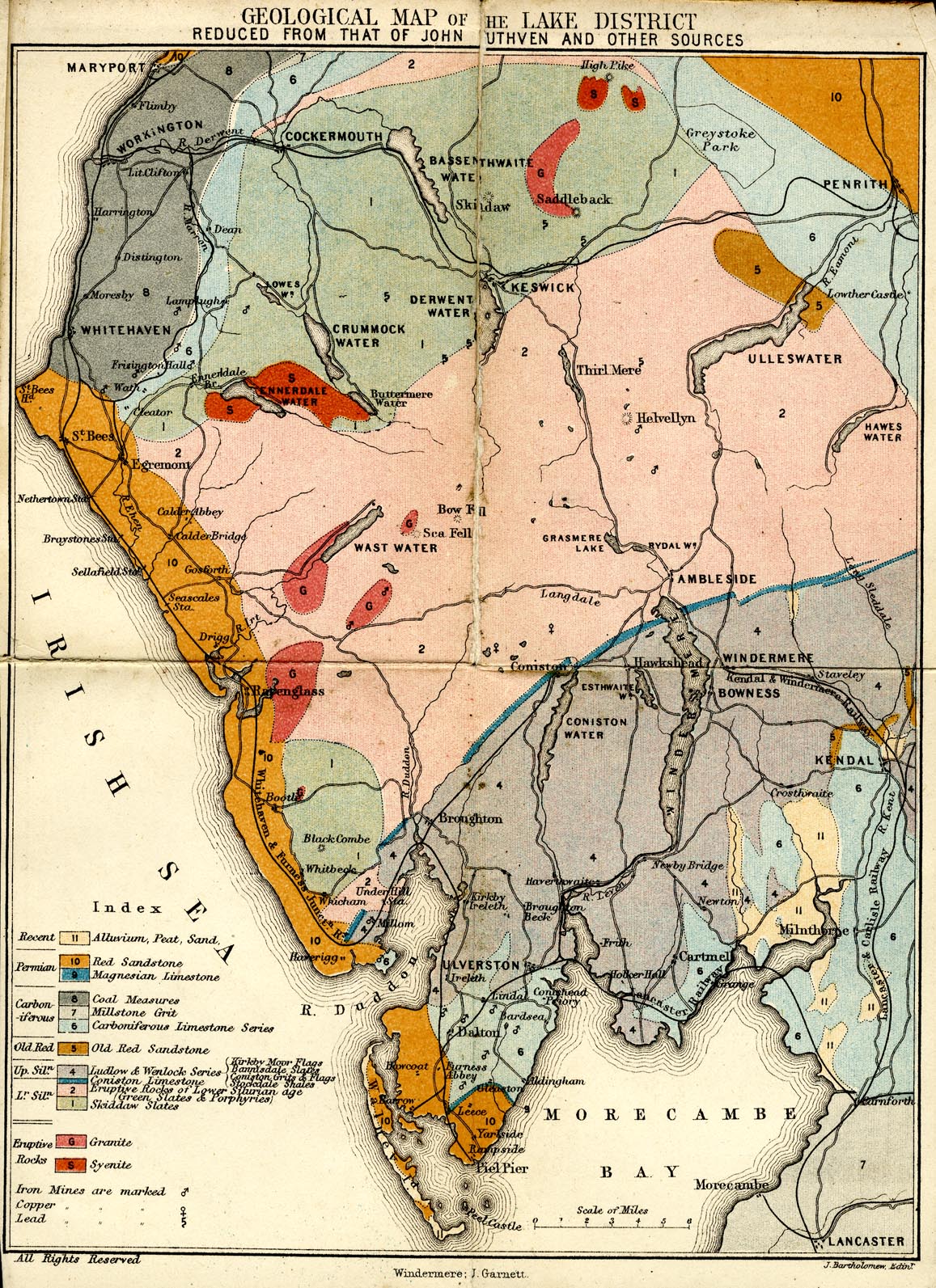
Map, colour lithograph, Geological Map of the Lake District,
scale about 6 miles to 1 inch, reduced from John Ruthven's map
etc, by J Bartholomew, Edinburgh, published by John Garnett,
Windermere, Westmorland, and by Simpkin, Marshall and Co,
London, 1865.
 Lakes Guides menu.