 Ford 1839 map

|

|
|

|
back to object record | |
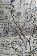
| Ford 1839 map, Longsleddale | ||
|
Notes about Longsleddale from the Map of the Lake District
of Cumberland, Westmoreland and Lancashire, scale about 3.5
miles to 1 inch, in A Description of Scenery in the Lake
District, by Rev William Ford, published by R Groombridge
and Sons, 5 Paternoster Row, London, and by Charles Thurnam,
5 English Street, Carlisle, Cumberland, 1850.
|
||
|
||
| Map Features | ||
|
|
||
| settlements |
Dale End is labelled:-
Dale End Coat copying from Leigh 1830. Further comparison makes the extent of copying clear. |
|
|
|
||
| scale |
The map scale is about:-
1 to 230000 ? 3.5 miles to 1 inch |
|
|
Places identified:-
|
||
Lakes Guides menu.