item:- Armitt Library : 2008.14.17
image:- © see bottom of page
 ELS6.jpg
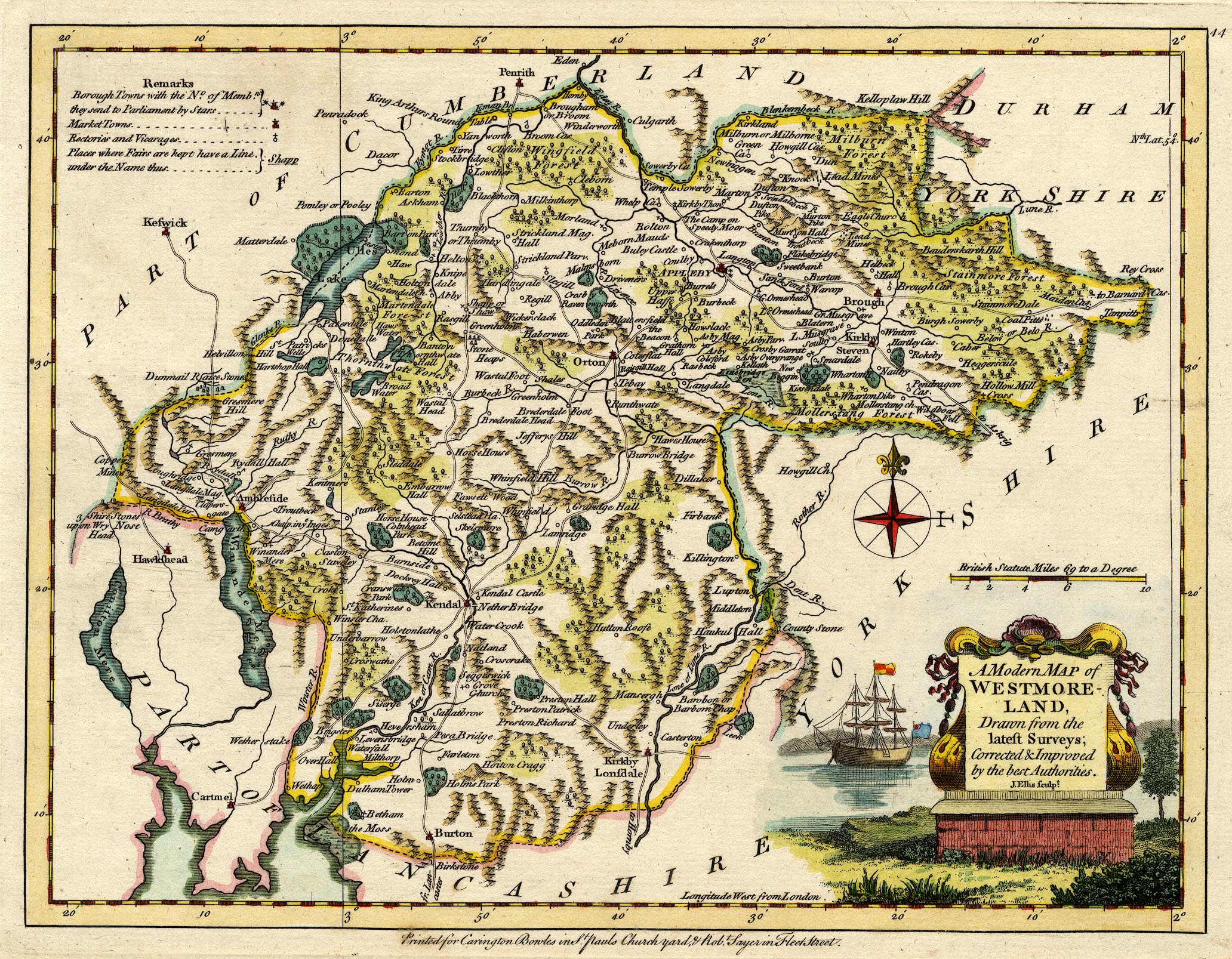
Map, hand coloured engraving, A Modern Map of Westmoreland ie
Westmorland, scale about 6 miles to 1 inch, by John Ellis,
London, 1765, published by Carington Bowles, St Pauls
Churchyard, and Robert Sayer, Fleet Street, London, 1766.
 Lakes Guides menu.