 Faden 1810

|

|
|

|
back to object record | |
| Faden 1810, Longsleddale | ||
|
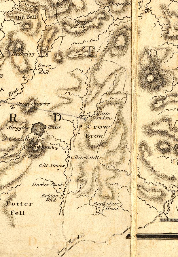
Notes about Longsleddale from the Map, The County of
Cumberland, and parts of Lancaster and Westmorland making a
map of The Lakes, scale about 2 miles to 1 inch, surveyed by
Thomas Donald, 1770-71, published by William Faden, Charing
Cross, London, 2nd edn 1810.
|
||
 courtesy of the Sedgwick Archive |
||
|
|
||
| scale |
The map scale is about:-
1 to 130000 2 miles to 1 inch |
|
Lakes Guides menu.