item:-
Armitt Library : 2008.14.57
image:-
©
see bottom of page
CY35.jpg
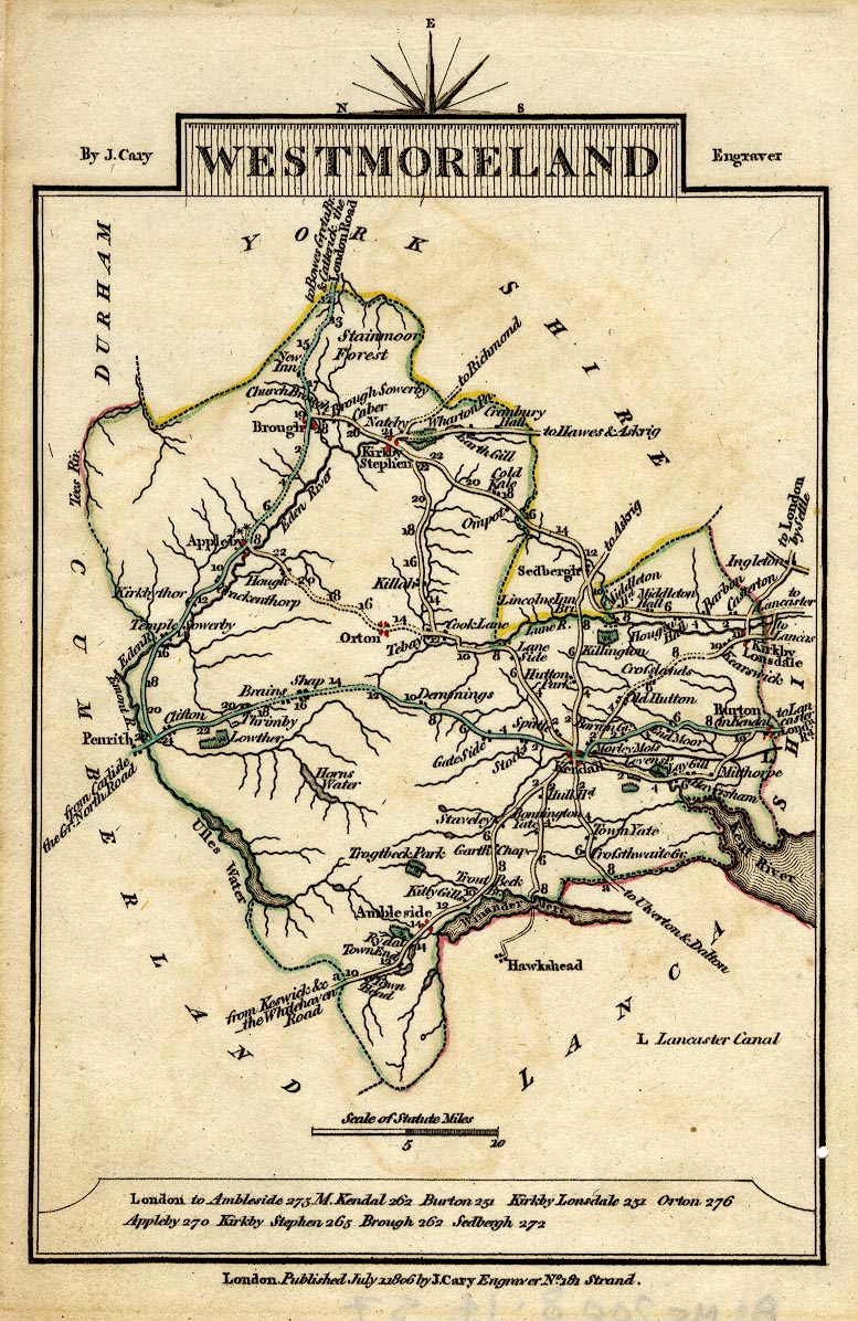
Road map, hand coloured engraving, Westmoreland, scale about 11.5 miles to 1 inch, by John Cary, 181 Strand, London, 1790, edn 1806.
Lakes Guides menu.
 Lakes Guides menu.