item:- JandMN : 182.3
image:- © see bottom of page
 CT12.jpg
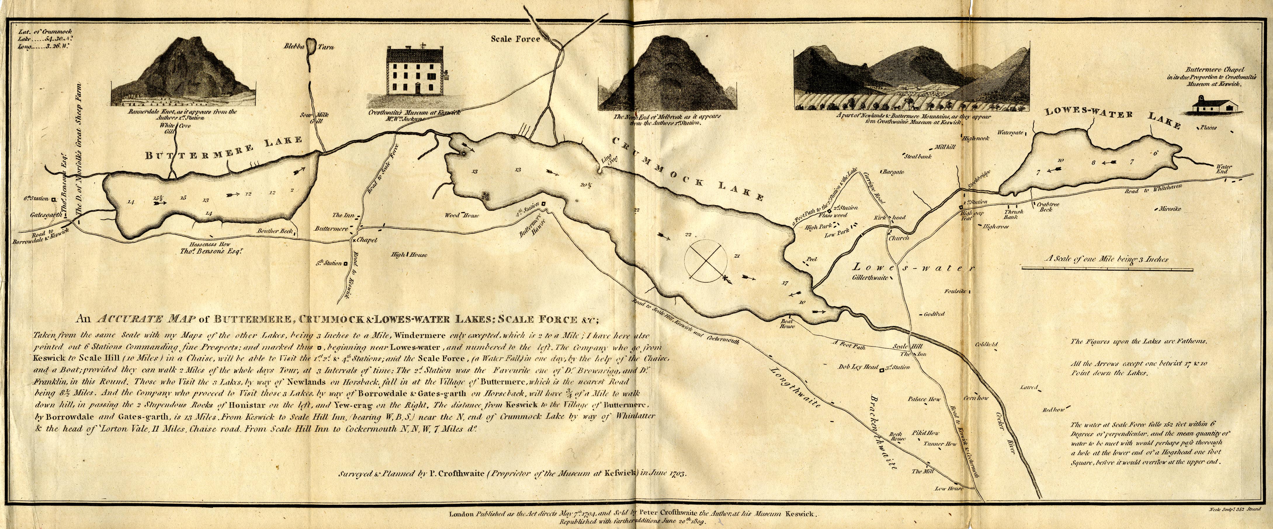
Map, uncoloured engraving, An Accurate Map of Buttermere,
Crummock and Loweswater Lakes, scale about 3 inches to 1 mile,
by Peter Crosthwaite, Keswick, Cumberland, 1794, version
published 1809.
 Lakes Guides menu.