item:- private collection : 10.10
image:- © see bottom of page
 CL10.jpg
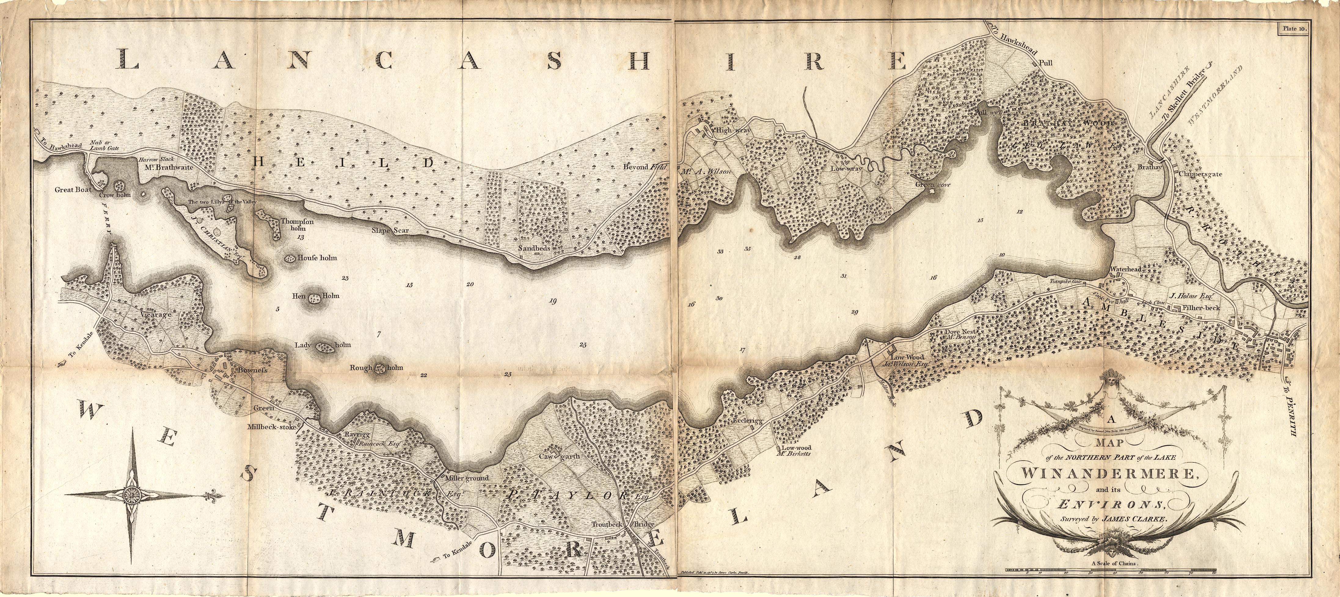
Map, A Map of the Northern Part of the Lake Winandermere and its
Environs, scale about 6.5 ins to 1 mile, by James Clarke,
engraved by Samuel John Neele, 352 Strand, published by James
Clarke, Penrith, Cumberland and in London etc, 1787.
 Lakes Guides menu.