 Bowles 1773

|

|
|

|
back to object record | |
| NOTES from BOWLES'S MAP of ENGLAND AND WALES, 1773 | ||
|
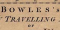
These notes are taken from a road map, Bowles's New
Travelling Map of England and Wales by Carington Bowles,
1773. The map studied is in a private collection.
|
||
|
The map size, not allowing for the gaps, is: wxh, sheet =
53.5x61cm; wxh, map:519x595mm. It is sectioned, mounted and
folded. These notes have a strong bias towards local
interest.
|
||
| MAP FEATURES | ||
|
|
||
|
title
map maker |
Printed upper left is:- BOWLES'S NEW TRAVELLING MAP OF ENGLAND AND WALES; Exhibiting all the DIRECT, AND PRINCIPAL CROSS ROADS; with the Distances from Town to Town according to the Mile stones, and other exact Admensurations. Printed for CARINGTON BOWLES, No.69 in St. Pauls Church Yard, LONDON. Printed at the bottom border is:- Published as the Act directs, 2 Jany. 1773. |
|
|
|
||
|
orientation
up is N |
The map has no compass rose or north point. It is printed
with North at the top of the sheet.
|
|
|
|
||
| scale |
The map has no scale line. Roughly estimated the scale is
about:-
25 miles to 1 inch |
|
|
|
||
|
lat and long
lat and long scales |
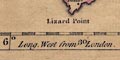
Printed in the map borders are scales of latitude and longitude for a trapezoid projection; chequered at 5 minute intervals, labelled at 30 minute intervals. Looking closely at the engraved degree marks for latitude, left and right, they appear slanted. It is possible to imagine that a conical projection is being suggested. As there is no graticule it is not easy to test this. The map includes from about 2d E to 7d W, 49d 45m to 56d 0m N; England and Wales with part of southern Scotland, and the east coast of Ireland, with routes marked. There is also a tiny corner of France. The prime meridian runs through central London, perhaps, only guessing, St Paul's Cathedral. The bottom longitude scale is labelled:- Long. East from London. Long. West from London. |
|
|
|
||
|
sea area
sea plain |
The sea is plain, some sea areas labelled, eg:-
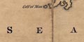
IRISH SEA |
|
|
|
||
|
coast line
coast form lines |
The coast line is emphasized by form lines. |
|
|
|
||
| rivers |
Rivers are only shown by their estuaries. It is possible to recognise some, the River Eden, for example. |
|
|
|
||
| county |
The county boundary is a dotted line, with a tint. County areas are labelled, eg:- WESTMORELAND |
|
|
|
||
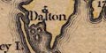
| settlements |
Settlements are positioned by a circle, with added
elements, differentiated by style of labelling. In
Hampshire:-
|
|
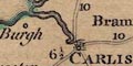
| city |
circle, buildings; labelled in upright block caps:-
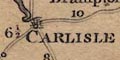
CARLISLE |
|
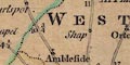
| town |
circle, perhaps a building, cross (+); labelled in
upright lowercase text, eg:-
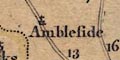
Ambleside Penrith Except:- APPLEBY in italic block caps, the de jure county town. |
|
| village |
circle; labelled in italic lowercase text, eg:-
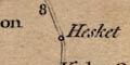
Hesket [High Hesket] |
|
|
|
||
|
roads
road distances |
Roads are drawn by a double line. Road distances from town to town are marked along the routes. At this scale only major routes are shown. |
|
Lakes Guides menu.