item:- private collection : 221
image:- © see bottom of page
 BO28.jpg
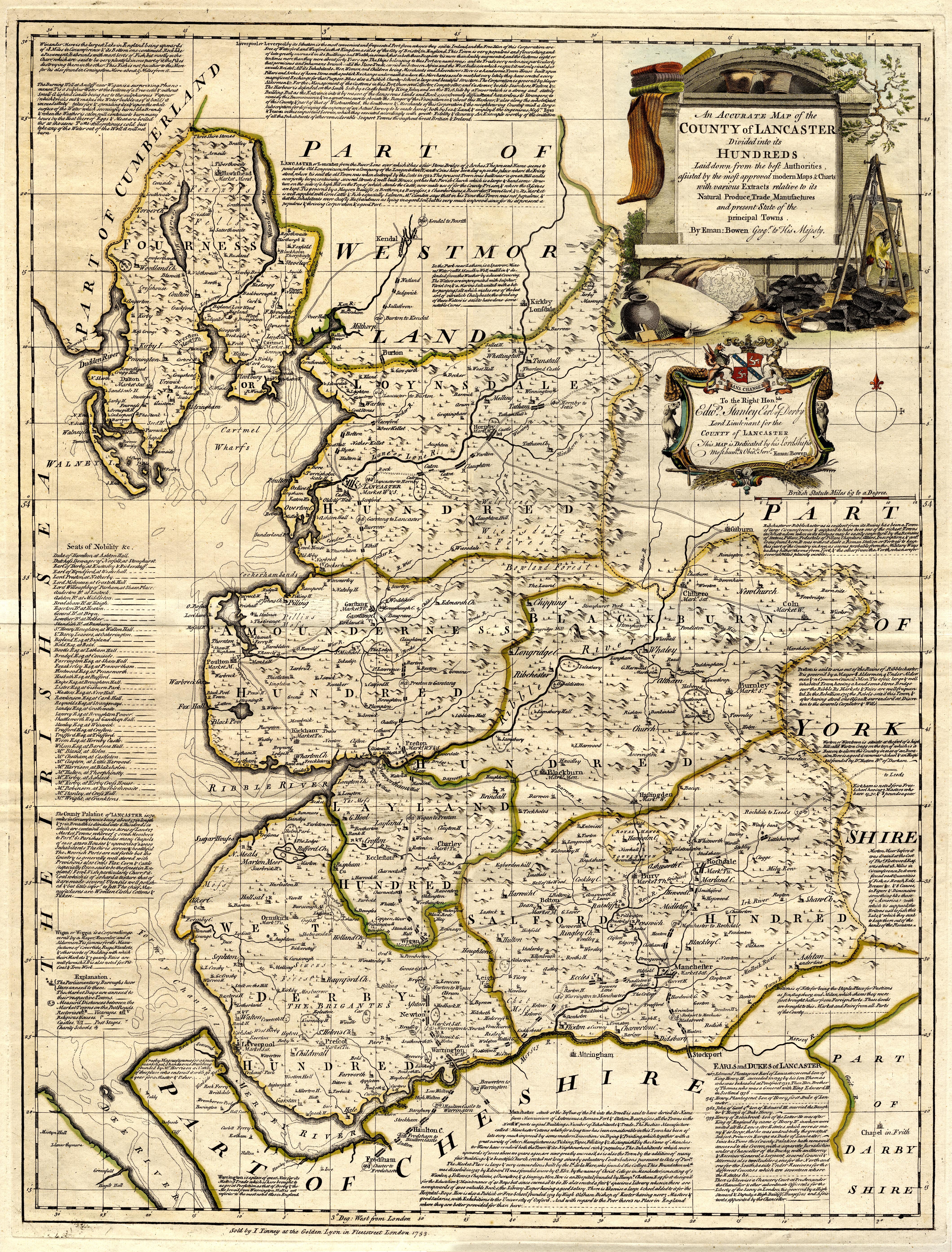
Map, hand coloured engraving, An Accurate Map of the County of Lancaster, scale about
3.5 miles to 1 inch, by Emmanuel Bowen about 1752, published by John Tinney, Golden
Lyon, Fleet Street, London, 1753.
 Lakes Guides menu.