item:- Armitt Library : 2008.14.121
image:- © see bottom of page
 BO22.jpg
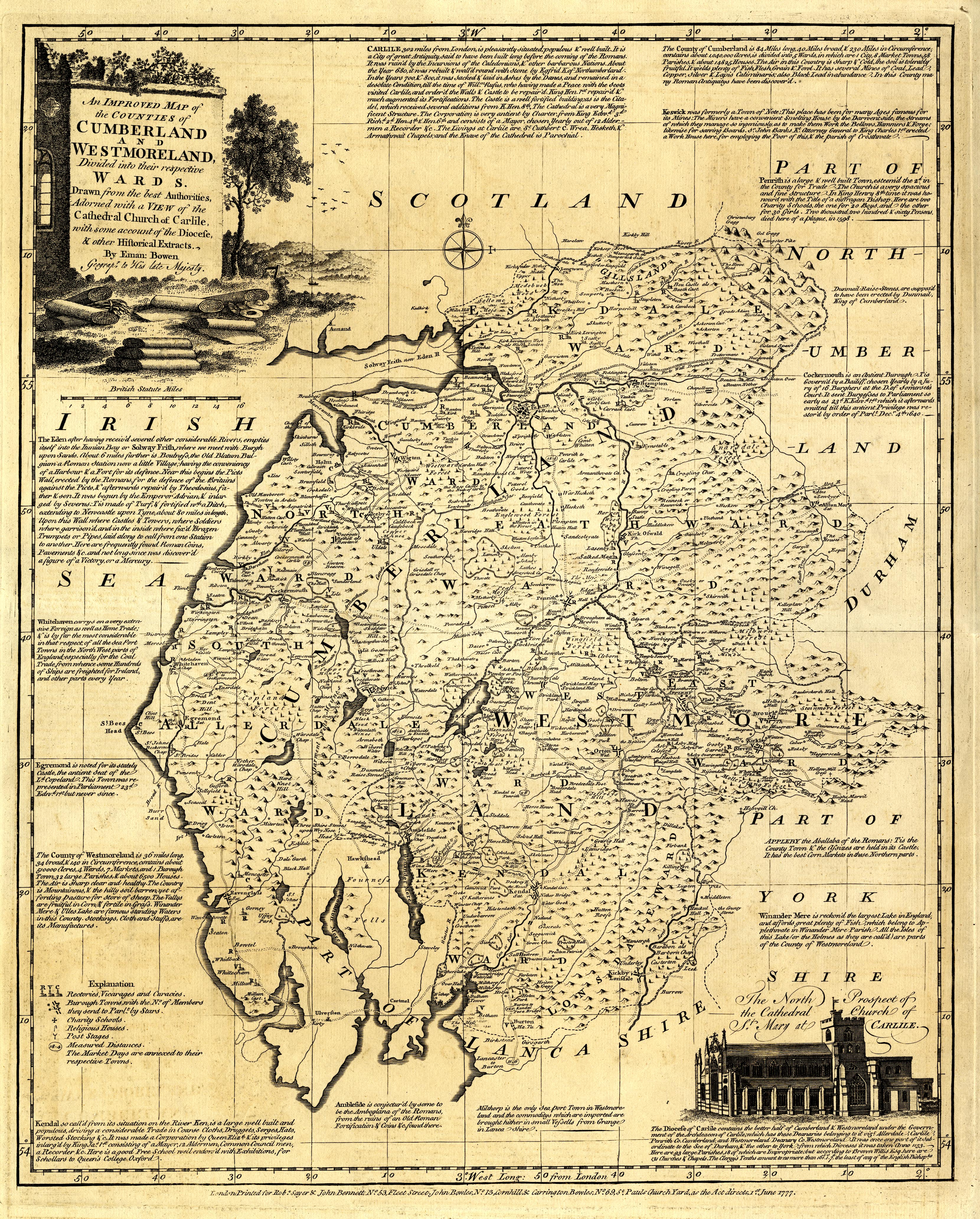
Map, uncoloured engraving, Improved Map of the Counties of
Cumberland and Westmoreland, by Emanuel Bowen, scale about 5.5
miles to 1 inch, published by Robert Sayer and John Bennett, 53
Fleet Street, John Bowles, 13 Cornhill, and Carrington Bowles,
69 St Paul's Churchyard, London, 1777-78.
 Lakes Guides menu.