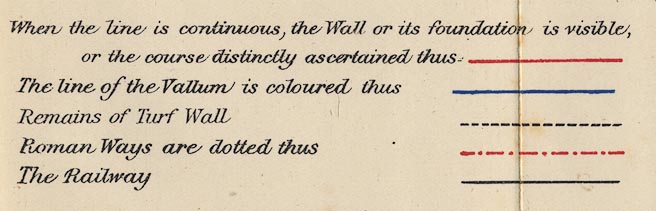
Map of the Roman Wall, in Cumberland and Northumberland, scale about 2 miles to 1 inch, derived from a survey for the Duke of Northumberland, 1853, by Robert Blair, 1909? (Blair 1909 map)
Lakes Guides menu.
 Lakes Guides menu.