item:- JandMN : 104.19
image:- © see bottom of page
 BGS619.jpg
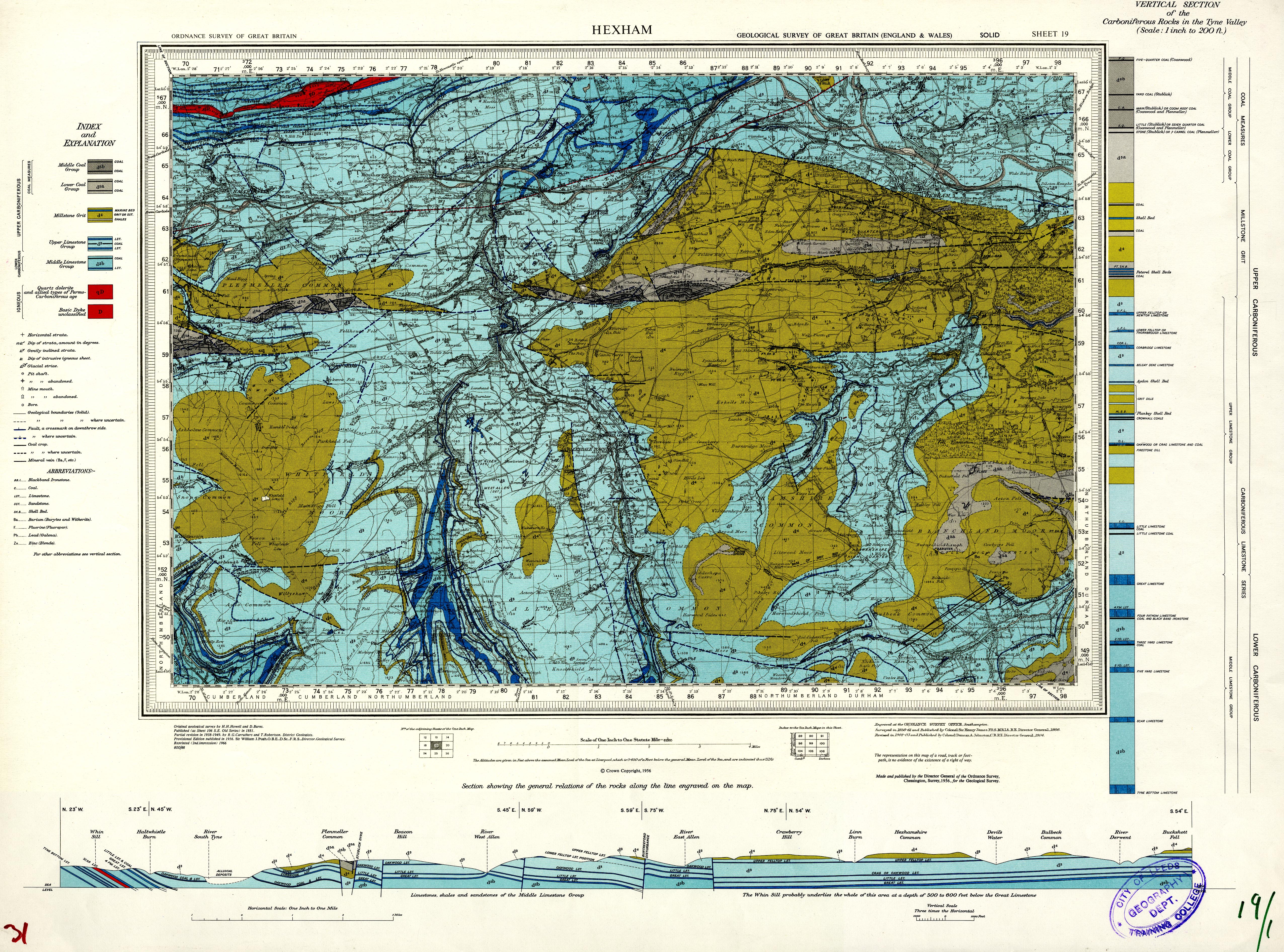
Geological map, sheet 19, Hexham area, Northumberland and
Cumberland, scale 1 inch to 1 mile, published for the Geological
Survey of Great Britain, by the Ordnance Survey, Southampton,
Hampshire, 1956.
 Lakes Guides menu.