item:- private collection : 271.3
image:- © see bottom of page
 JEF6M3.jpg
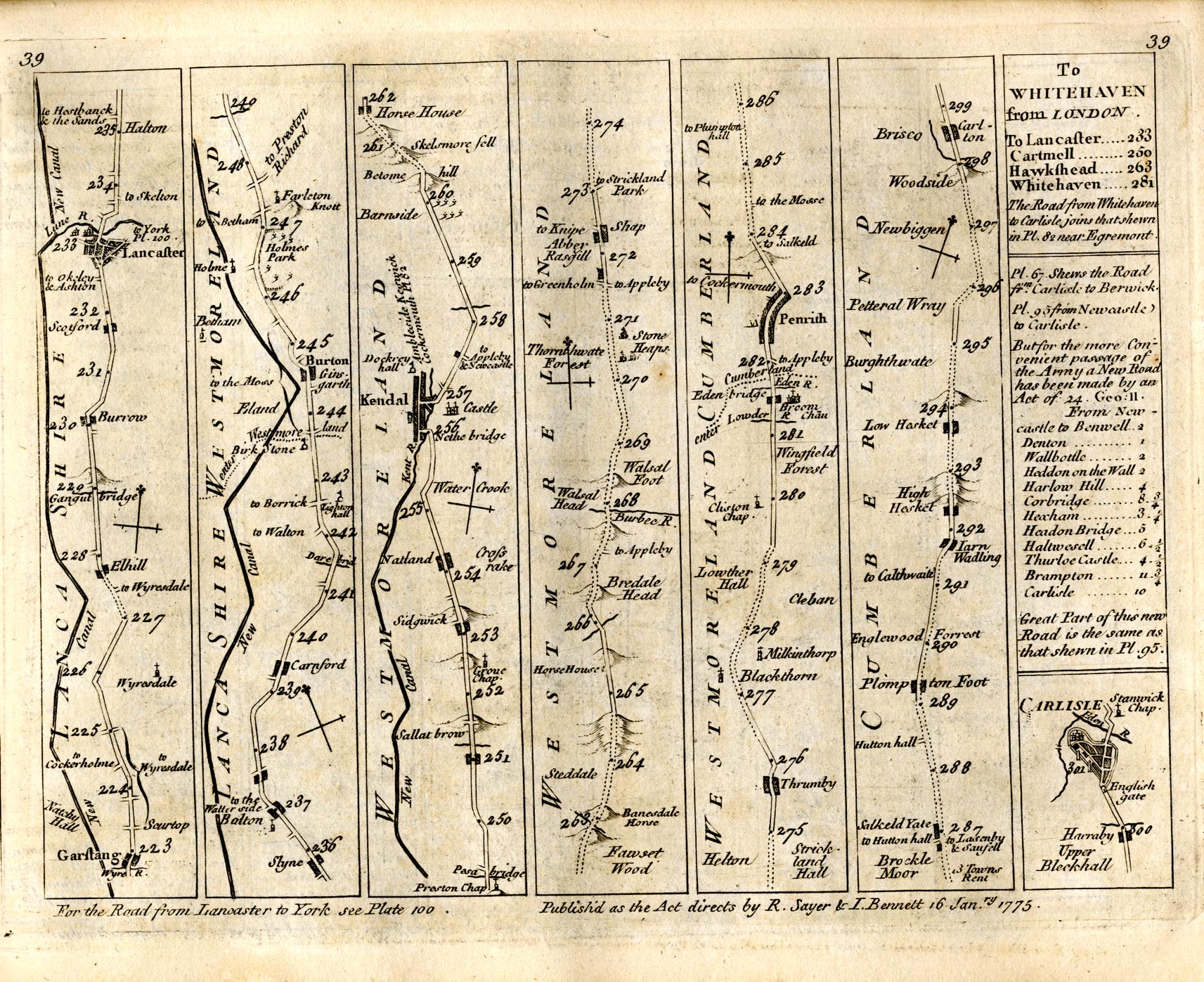
Strip map, road map, plate 39, part of From London to Carlisle, from Garstang through
Lancaster, Lancashire; then Burton-in-Kendal, Kendal, Shap, Westmorland; Penrith to
Carlisle; and an itinerary from Lancaster to Whitehaven, scale about 2 miles to 1
inch, by Thomas Jefferys, published by R Sayer and J Bennett, 53 Fleet Street, London,
1775.
 Lakes Guides menu.