item:- private collection : 271.2
image:- © see bottom of page
 JEF6M2.jpg
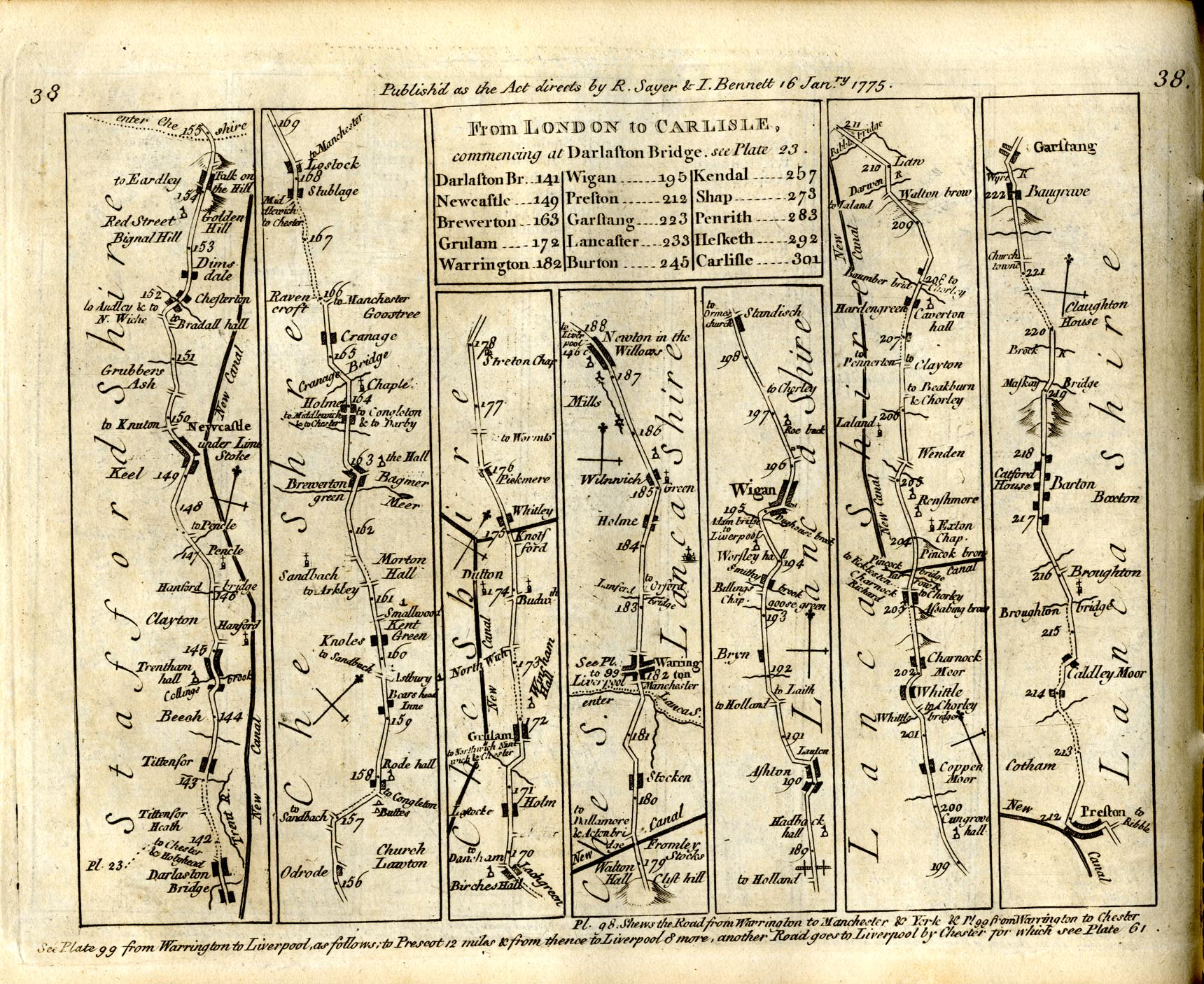
Strip map, road map, plate 38, part of From London to Carlisle, with the itinerary
of the whole route, scale about 2 miles to 1 inch, by Thomas Jefferys, published by
R Sayer and J Bennett, 53 Fleet Street, London, 1775.
 Lakes Guides menu.