item:- Armitt Library : A745.148
image:- © see bottom of page
 HMW147.jpg
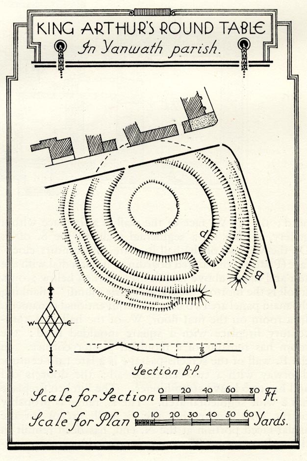
Site plan, uncoloured lithograph, King Arthur's Round Table, Eamont Bridge, Yanwath
and Eamont Bridge, Westmorland, scale about 1 to 1900, published by Royal Commission
on Historical Monuments England, London, 1936.
 Lakes Guides menu.