 Old Cumbria Gazetteer
 |
 |
|
| Hardindale Knott, Borrowdale | ||
| Hardindale Knott | ||
| locality:- | Manesty | |
| civil parish:- | Borrowdale (formerly Cumberland) | |
| county:- | Cumbria | |
| locality type:- | headland | |
| coordinates:- | NY25631917 | |
| 1Km square:- | NY2519 | |
| 10Km square:- | NY21 | |
| references:- | Clarke 1787 |
|
|
|
||
| evidence:- | old text:- Clarke 1787 placename:- Hardendale Knott |
|
| source data:- | Guide book, A Survey of the Lakes of Cumberland, Westmorland,
and Lancashire, written and published by James Clarke, Penrith,
Cumberland, and in London etc, 1787; published 1787-93. goto source goto sourcePage 83:- "... a rock at the water-head; I have not a name for it, but it lyes towards the south of, and near Hardendale-Knott: ..." |
|
|
|
||
| evidence:- | old map:- Clarke 1787 map (Der) placename:- Hardindale Knott |
|
| source data:- | Map, uncoloured engraving, Map of Derwentwater and its Environs,
scale about 13 ins to 1 mile, by James Clarke, engraved by S J
Neele, published by James Clarke, Penrith, Cumberland and in
London etc, 1787.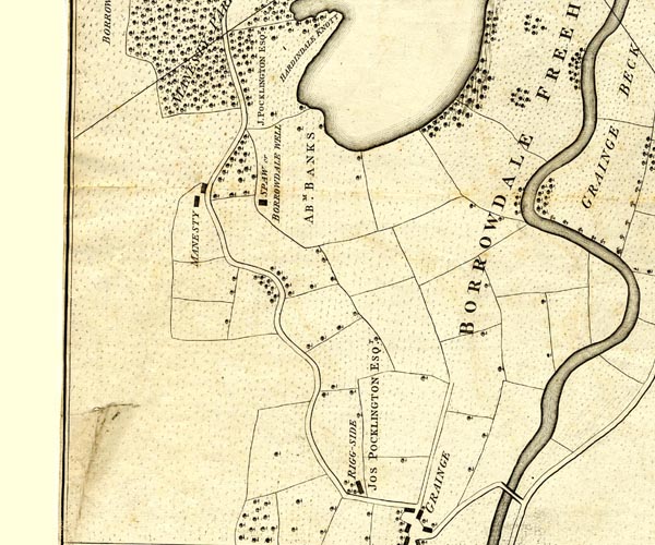 CL152518.jpg "HARDINDALE KNOTT" headland item:- private collection : 169 Image © see bottom of page |
|
|
|
||
Lakes Guides menu.