 Old Cumbria Gazetteer
 |
 |
|
| Gale Sike | ||
| runs into:- |  Castlethwaite Gill Castlethwaite Gill |
|
|
|
||
| civil parish:- | Mallerstang (formerly Westmorland) | |
| county:- | Cumbria | |
| locality type:- | river | |
| 1Km square:- | NY7902 (etc) | |
| 10Km square:- | NY70 | |
|
|
||
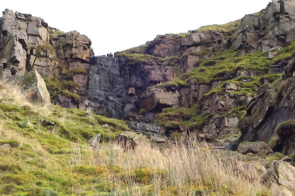 CGW80.jpg waterfall? (taken 8.11.2017) |
||
|
|
||
| evidence:- | old map:- OS County Series (Wmd 30 15) placename:- Gale Sike |
|
| source data:- | Maps, County Series maps of Great Britain, scales 6 and 25
inches to 1 mile, published by the Ordnance Survey, Southampton,
Hampshire, from about 1863 to 1948. |
|
|
|
||
| evidence:- | perhaps old map:- Speed 1611 (Wmd) |
|
| source data:- | Map, hand coloured engraving, The Countie Westmorland and
Kendale the Cheif Towne, scale about 2.5 miles to 1 inch, by
John Speed, 1610, published by George Humble, Popes Head Alley,
London, 1611-12.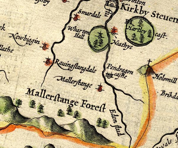 SP14NY70.jpg double line, into the Eden item:- Armitt Library : 2008.14.5 Image © see bottom of page |
|
|
|
||
Lakes Guides menu.