 Old Cumbria Gazetteer
 |
 |
|
| St Giles, Crackenthorpe | ||
| St Giles' Chapel | ||
| locality:- | Chapel Wood | |
| locality:- | Crackenthorpe | |
| civil parish:- | Crackenthorpe (formerly Westmorland) | |
| county:- | Cumbria | |
| locality type:- | chapel (gone) | |
| locality type:- | church (gone) | |
| coordinates:- | NY66782175 (?) | |
| 1Km square:- | NY6621 | |
| 10Km square:- | NY62 | |
| references:- | OS County Series |
|
|
|
||
| evidence:- | old map:- OS County Series (Wmd 9 14) placename:- St Gile's Chapel |
|
| source data:- | Maps, County Series maps of Great Britain, scales 6 and 25
inches to 1 mile, published by the Ordnance Survey, Southampton,
Hampshire, from about 1863 to 1948. "St Gile's Chapel (Site of)" |
|
|
|
||
| evidence:- | perhaps old map:- Jefferys 1770 (Wmd) |
|
| source data:- | Map, 4 sheets, The County of Westmoreland, scale 1 inch to 1
mile, surveyed 1768, and engraved and published by Thomas
Jefferys, London, 1770.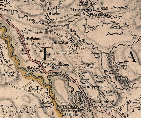 J5NY62SE.jpg pillar or building by the road at Roger Head item:- National Library of Scotland : EME.s.47 Image © National Library of Scotland |
|
|
|
||
 Lakes Guides menu.